Historical Eelgrass Abundance: Megansett Harbor
Note: The data and maps on this page will be included in a forthcoming report summarizing changes in eelgrass distribution in Buzzards Bay. The information is posted here to facilitate review of the information, but the data should be considered to be in draft form and subject to change.
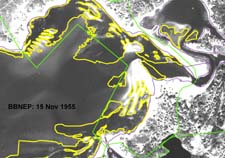
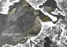
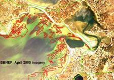
The source photo for the DEP 1951 coverage was not available, but like the delineations in other embayments for this data set, it is somewhat simplified representation and includes bare areas that elevate bed areas relative to other mapped periods. The bed on the south center side of the harbor includes a small area that may be too deep (area below 12 foot contour line) to include eelgrass (compare to 1981 image below), but overall, the distribution in the DEP coverage is consistent with latter imagery presented here. In the GIS data set, DEP described the bed in Squeteague Harbor as low density and patchy coverage, but with low confidence in identification (i.e. the feature could be Ruppia or drift algae). The boundary marked in green represents the spatial extent of the trends analysis, and avoids deep areas where there is often difficulty in photo interpretation, and Squeteague Harbor, which is considered separately.
Summary
Megansett and Squeteague Harbors are really the outer and inner portions of a larger embayment complex. This page only summarizes eelgrass in Megansett Harbor; Squeteague Harbor is summarized separately. This embayment is a large open-mouthed and well flushed system that has good water quality as documented in the Buzzards Bay Baywatchers water quality monitoring program.
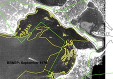
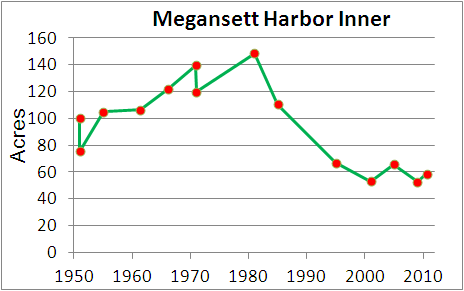
Like other well flushed embayments around Buzzards Bay, such as Hiller Cove, Point Connet Coves, and East Cove of West Island, Fairhaven, eelgrass showed expansion during the 1950s to early 1980s, but unlike some of these other systems, eelgrass in Megansett Harbor appears to have declined somewhat after the mid-1980s.
Mooring Impacts
There are few moorings in Megansett Harbor, with most located in the basin in front of the channel leading to Squeteague Harbor, opposite the Megansett Yacht Club. In earlier photographs, there appears to be a mixture of eelgrass and drift material in the basin and channel, and in later photographs, it appears the basin was dredged deeper. This basin area is the most likely area to have been stressed by moorings and boating activity. Squeteague and its channel are relatively shallow, so fewer and smaller boats are located there.
Previous Summaries
None available.
Megansett Harbor Historical Changes
[additional text to be added]
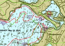
The source photo for the DEP 1951 coverage was not available, but it appears to be a somewhat simplified representation as compared to the analysis of other imagery presented here, and includes some bare areas (see text for explanation). Compare to 1951 interpretation, right.
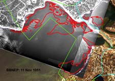
Buzzards Bay NEP interpretation of a 11 November 1951 Black and White aerial photograph (southwestern most portion of harbor not available for analysis). Compare to DEP 1951 map above.
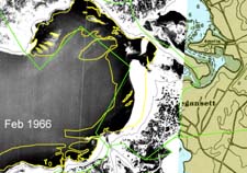
This imagery, from February 1966, is impaired by extensive ice and snow cover, and otherwise less than ideal conditions. The inner boundary of ice covered beds was based on average inner bed boundaries from other bracketing dates.
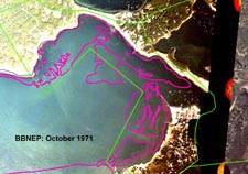
This imagery, from 8 October 1971, has only average water transparency, but there is sufficient contrast to delineate the shallow beds.
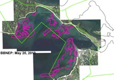 Eelgrass in Megansett Harbor, estimated from May 20, 2010 imagery. Note the sparseness of eelgrass in this area. Contrast this image to the apparent denser beds on the same date in Wild Harbor.
