2013 CCMP, Chapter 2:
Buzzards Bay: Its Watershed, Living Resources, and Governance
About the new Buzzards Bay CCMP Action Plans
The Buzzards Bay Comprehensive Conservation and Management Plan (CCMP) was updated in November 2013 to reflect the great progress achieved since the original CCMP was finalized. You can download the entire document (buzzards-bay-ccmp-2013-update.pdf) or just this Chapter.
This page has only a few highlights of this chapter. Read the actual text of Chapter 2 as a pdf file (1.0 MB), with graphics.
Buzzards Bay: Its Watershed, Living Resources, and Governance
Buzzards Bay Setting
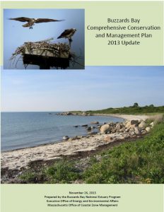
Buzzards Bay is a moderately large estuary located between the western most part of Cape Cod, Southeastern Massachusetts, and the Elizabeth Islands. The bay is 28 miles long (45 kilometers), averages about 8 miles (12 kilometers) in width, and has a mean depth of 36 feet (11 meters). It is approximately 228 square miles (590 square kilometers) in size. The coastline stretches over 280 miles (470 kilometers) and includes 11 miles (18 kilometers) of public beaches that lure thousands of tourists from Massachusetts and neighboring states.
The Buzzards Bay watershed or drainage basin (defined also in this document as the NEP study area , Figure 4) covers 435 square miles (1209 square kilometers) and includes portions of 21 municipalities in two states, although 5 towns, including the two in Rhode Island, have relatively small areas (<14%) within the Buzzards Bay watershed. A complete list of all the communities and their area and population within the watershed are shown in Table 1.
The ratio of watershed land area to water surface is 1.9:1. This is relatively low compared to other National Estuary Programs and large east coast estuaries such as Chesapeake Bay and Delaware Bay, which have landtowater ratios of 14.5:1 and 17.3:1 respectively. Approximately 249,000 people reside in the drainage basin at an average concentration of 572 per square mile, or 0.9 people per acre.
The bay itself is part of an interconnected hydrologic system that includes several rivers. Groundwater seepage accounts for a large part of the freshwater inflow to Buzzards Bay, particularly in Wareham, Bourne, and Falmouth that have large sandy soiled glacial outwash plains and till areas. Along its western shore (west of the Cape Cod Canal) the drainage basin is formed by seven major river basins and a number of smaller ones. The largest river basins include the Agawam, Wankinco, Weweantic, Mattapoisett, Acushnet, Paskamanset, and Westport.
As noted above, the eastern shore of Buzzards Bay (Cape Cod Canal to Woods Hole) is drained mostly by groundwater. Several river systems smaller than those on the western shore also drain this portion of the basin. The prominent freshwater streams along the eastern shore are the Back, Pocasset, and Wild Harbor Rivers and Herring Brook.
In general, rivers within the Buzzards Bay drainage basin are slowmoving, meandering streams near their headwaters and for most of their freshwater length. Nearing the coast, particularly on the western shore, past glacial erosion of the bedrock created wide river valleys that are today submerged, creating a network of broad fringing tidal estuaries. On average, Buzzards Bay rivers are considerably shorter (usually much less than 20 miles (34 kilometers) and have smaller drainage areas than other rivers within the state.
Physical Features of the Bay
Geologic Formation
For millions of years, the shore and continental shelf of southern New England was periodically submerged and exposed by the ocean as the climate repeatedly warmed then cooled, and glaciers advanced and retreated across the northern hemisphere, causing sea levels to rise and fall. The foundation for the modern configuration of Buzzards Bay was formed by the last ice age.
During the last ice age, over many tens of thousands of years, great masses of glacial drift, chiefly boulders, gravel, sand, and clay were deposited at the leading edge of the Laurentide ice sheet. When the ice cap began receding 15,000 years ago, these moraines of unstratified glacial drift formed large hills on the eastern and southern sides of a large valley, and formed what are Bourne, Falmouth, and the Elizabeth Islands today.
As the ice cap continued to recede across Canada, sea level rose hundreds of feet. Still, as late as 89,000 years ago, all of Buzzards Bay remained an upland valley, with rivers flowing into the sea along the western side of the bay in various configurations that would later form the irregular coastline of the bay as the rising sea drowned these ancient river valleys. Five thousand years ago, see level was still roughly 36 feet lower in southern New England than today, and the northern end of Buzzards Bay would have formed a line across between north Falmouth and Mattapoisett.
By four thousand years ago, the rise of sea level slowed considerably. During the past millennia, relative sea level rise may have only been 8 feet . As the sea level rose, and bluffs were eroded by waves and storms, many of the bays and inlets that formed became sheltered from the ocean through the formation of barrier spits and islands.
Hydrologic Features
The hydrologic features of the bay and its embayments are driven by tidal circulation, freshwater flow, salinity stratification, winds, and temperature. Tidal currents and wind are the dominant circulation forces in Buzzards Bay because the Elizabeth Islands protect the bay from large, long-period, open-ocean waves. Complete tidal mixing of bay water with ocean water is estimated to occur every 10 days (Signell, 1987).
[etc. Open the pdf version to see maps, tables, and the rest of the text.]