Related pages: FEMA LIDAR | Watershed Boundaries | Nautical Maps
Go to MassGIS data layers page
Buzzards Bay NEP GIS Data
Note: These data are in ArcMapTM shapefiles, with NAD83 meters coordinates, consistent with MassGIS coverages. The shapefile coverages are all contained in zip files unless otherwise specified. You should right click on the link to save the file to your computer if it is very large, or you can left click to have your browser open the zip file. This is not a complete list of files on our website, and you might wish to use the search button to see if we have a particular coverage.
General Buzzards Bay Data Sets
2023 Buzzards Bay watershed towns Protected Open Space
Buzzards Bay Shellfish DSGA interim 2024 data prepared by the Buzzards Bay NEP (not official, DMF has not yet posted GIS data).
2003 Buzzards Bay NEP’s Filled Wetlands Atlas Volume I sites
Buzzards Bay Salt Marsh Atlas Tidal Restrictions and Phragmites areas
(two coverages included in a 178 kb zip files)
Buzzards Bay Sewered Areas (2024 update)
This is a generalized coverage best for watershed and regional maps. Data coverage for Otis Air Force base is estimated. Prepared January 8, 2015.
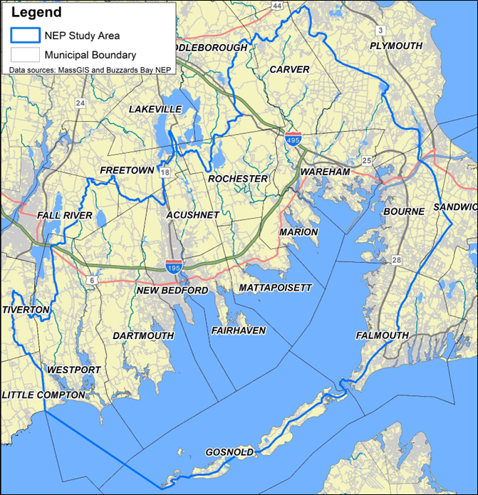
Buzzards Bay Study Area
In 2009, the NEP “Study Area” definition (jurisdictional interests of the program) was revised to be consistent with the Massachusetts Ocean Plan area and coincident with the boundary of Massachusetts state waters, and within recently defined state and federal designations for the boundary of Buzzards Bay. In 2014, 2021, and 2024, the boundary was further refined as described on our NEP study area, especially in the northern boundary, and Cape Cod boundary further to reflect new watershed boundaries defined by the Massachusetts Estuaries Project and USGS models in those areas. Download the zipped shapefile: BBNEP_study_area_2024update.zip.
Buzzards Bay Subbasins
This 2017 subbasin coverage is currently being used by the Buzzards Bay NEP: BBNEP_SUBBASINS_2017.zip.
Specialized Coverages

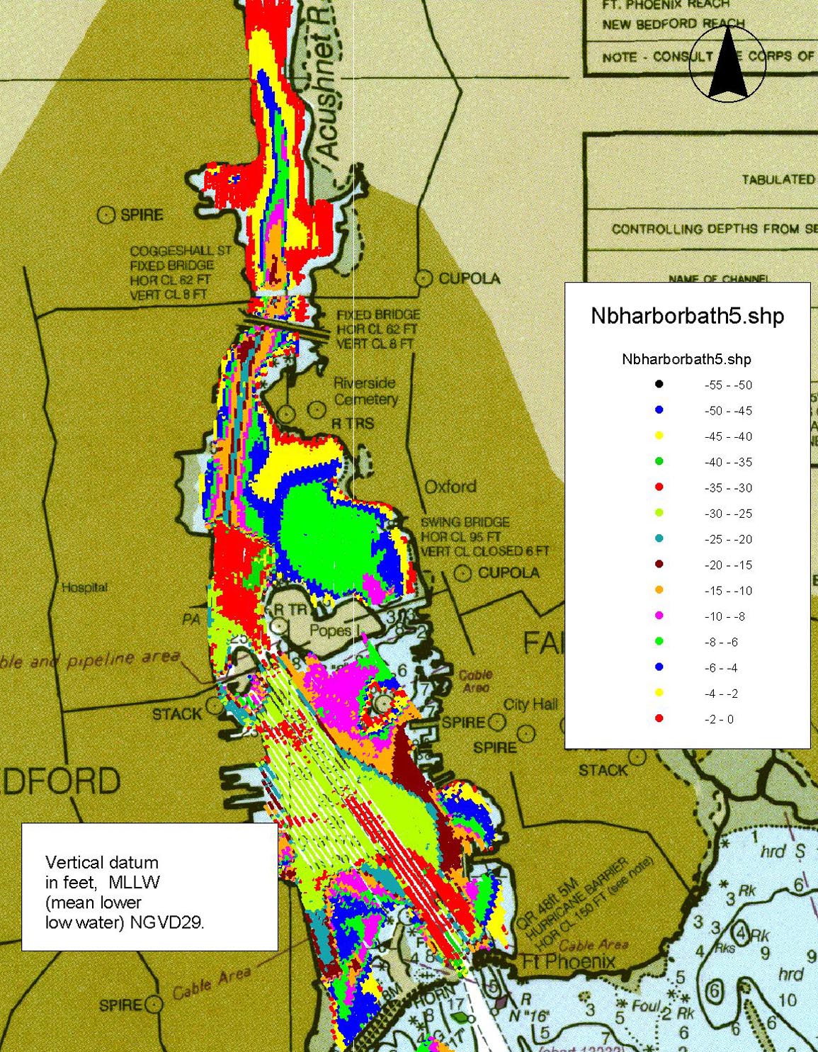
New Bedford Harbor Bathymetry
(color coded map, 496 kb JPG)
New Bedford Harbor Bathymetry GIS Shapefiles
This is a 565 kb zip file that opens into the three necessary ArcView files. Depths as NGVD29 feet at MLLW (mean lower low water). This data is shown in the image to the right.
Links to Other Data Download Sites with Buzzards Bay Coverages
Great federal site for LiDAR data: NOAA Data Access
Massachusetts Ocean Resource Information System
NOAA Nautical Chart Viewer and downloader including GIS format
Historical Aerial Photos: Earth explorer at USGS
Install Google Earth
With Google earth, you can select aerials from different dates as the base map.
Disclaimer
All documents, files or other data accessible on or through this web site are provided solely as a courtesy to facilitate public access to information. Documents, files or other data are “as is” without any warranty of any kind. Read our full site disclaimer