Introduction
Salt marshes in Buzzards Bay play a vital role by providing habitat, regulating water quality, and stabilizing coastlines. In recent years, many coastal communities have experienced degradation or loss of salt marshes. To better understand this trend, the Buzzards Bay NEP is working with the Buzzards Bay Coalition and scientists at the Woodwell Climate Research Center to track salt marsh loss in Buzzards Bay principally caused by factors related to climate change. These scientists are looking at how the use of runnels—constructed shallow drainage meanders—may promote revegetation in upper areas of salt marsh that are dying off from standing water. The results of this work will help town officials and state and federal managers develop possible mitigation strategies to protect and restore salt marshes. Assistant Professor Alice Besterman of Towson University is the lead investigator.
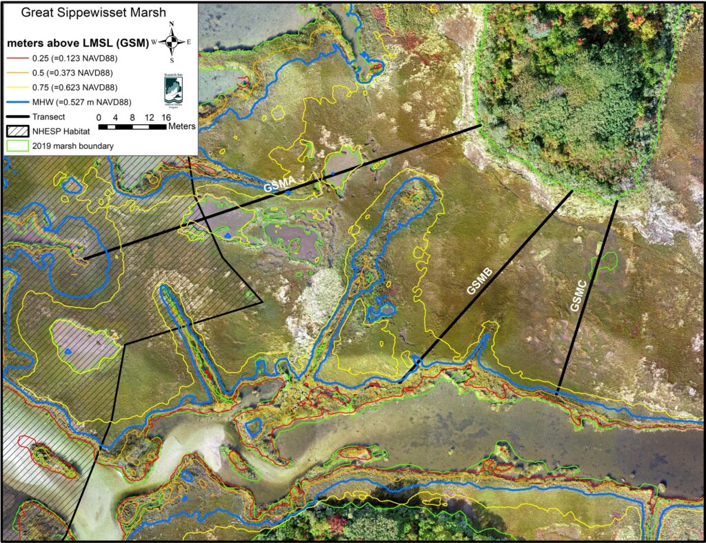
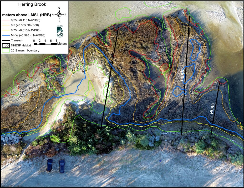
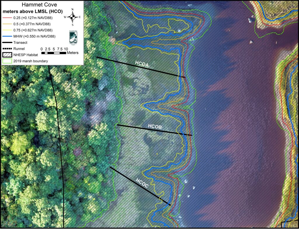
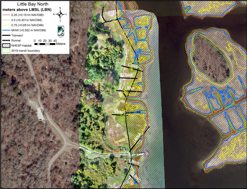
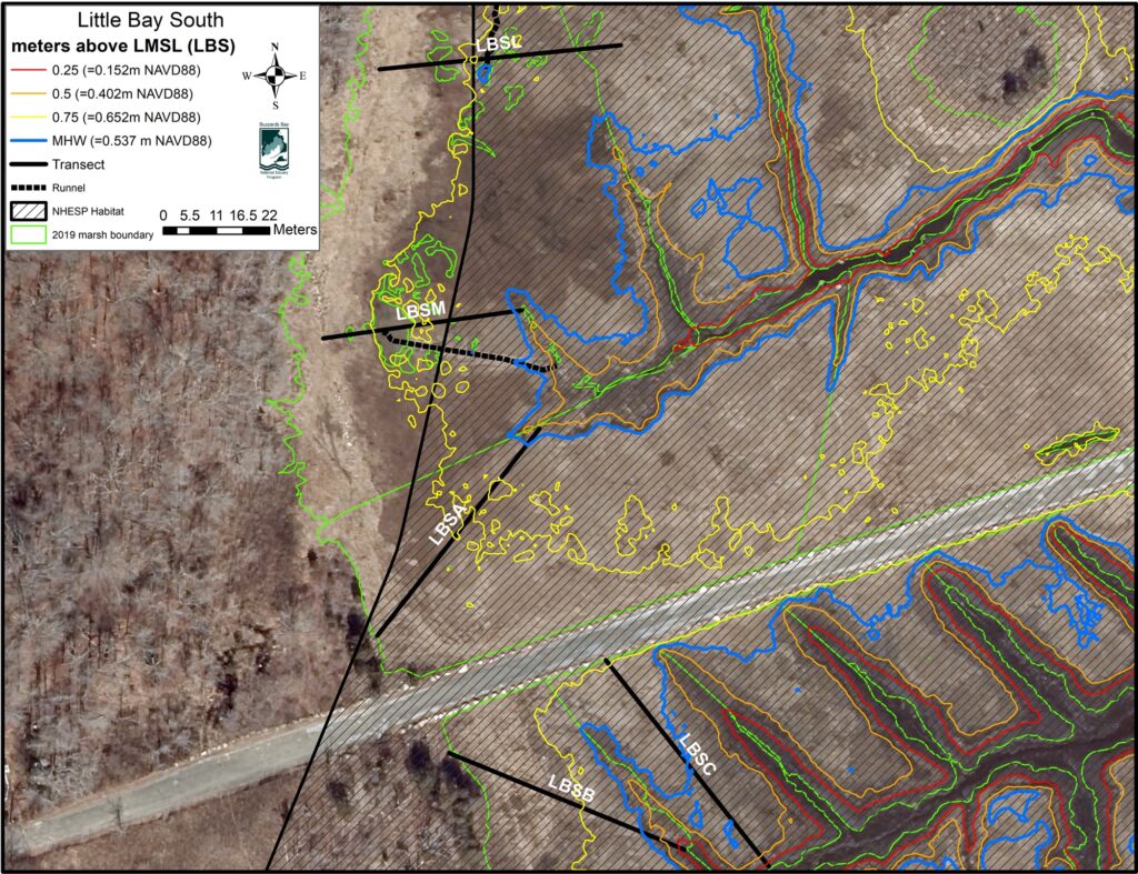
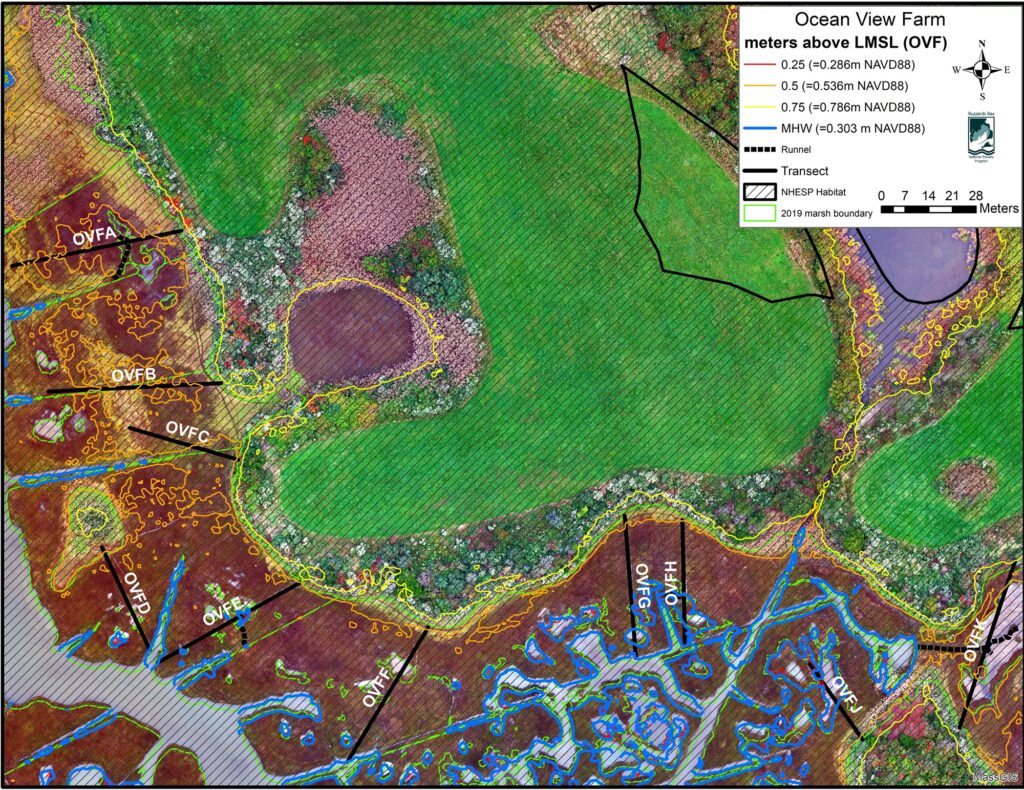
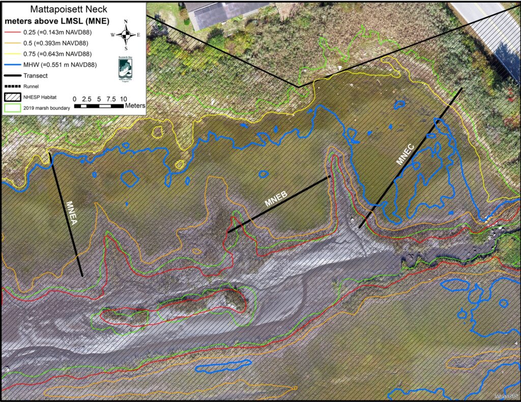
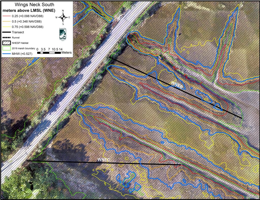
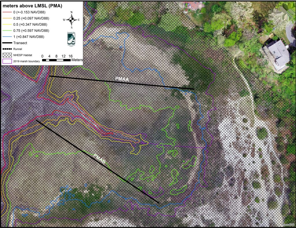
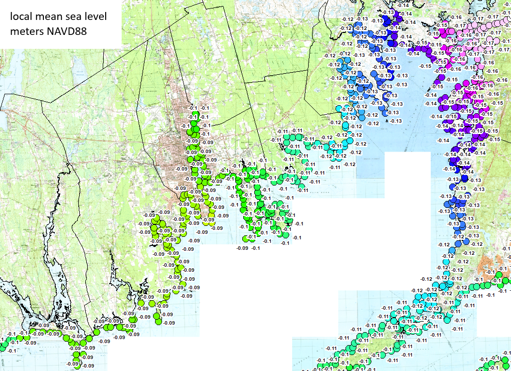
Standing water often occurs in shallow pools of water that scientists call salt marsh pannes. Investigators found that the higher the elevation of the panne, the more successful the runneling approach was in restoring vegetation to the salt marsh. In Buzzards Bay, the tidal range (the difference between mean high water and mean low water) varies between 4 feet (1.2 m) at the north end of the bay near Wareham, to about 3 feet (0.9 m) at the south end near Westport. Similarly, the real-world elevation of local mean sea level (LMSL) varies around the bay, but by only a few inches. It also happens that the local mean sea level is near the lower boundary of the salt marsh. In selecting a potential site for the use of runnels, managers must consider the elevation of the panne. The map below shows the elevation of LMSL around Buzzards Bay using the datum NAVD88. The investigators found that an unvegetated panne with an elevation of 0.75 m or more above these elevations will have the greatest likelihood of revegetation by the runneling technique. In most of Buzzards Bay, 0.75 feet above LMSL is above the mean high-water mark. To calculate the elevation of a panne, you must use Lidar data for the site you are considering. In the maps for each study site below we show 0.25-, 0.30-, and 0.75-meter contours above LMSL to show where these elevations occur on a marsh. Because tidal range is lower in Buzzards Bay than the rest of Massachusetts (see our tidal datums of Massachusetts page), a general rule of thumb is that runneling will be most successful where areas of standing water are near or above the mean high-water mark. To find the mean high-water elevation for your site in Massachusetts, use our Tidal Datum Viewer interactive map. Then go to NOOA’s Data Access Viewer Lidar page to download contours for your site, using the elevation of mean high-water elevation as the zero elevation of your contours.
Site maps