Established in 1985 as the Buzzards Bay Project, our mission is to protect and restore water quality and living resources in Buzzards Bay and its watershed through the implementation of the Buzzards Bay Comprehensive Conservation and Management Plan.
In 2015, the Buzzards Bay National Estuary Program (NEP), in partnership with the Buzzards Bay Action Committee, and five Buzzards Bay municipalities (the Towns of Dartmouth, Acushnet, Fairhaven, Mattapoisett and Wareham), established the Buzzards Bay Stormwater Collaborative. The goal of the Collaborative was to help municipalities manage stormwater pollution, primarily by mapping stormwater networks and monitoring stormwater discharges. These are among the most difficult, time consuming, and costly tasks towns face in their stormwater management programs.
In the fall of 2018, the Massachusetts Maritime Academy (MMA), a Massachusetts state college, joined the effort by establishing a program for their students to participate. Three more towns joined the Collaborative as well (the Towns of Bourne, Marion, and Westport). Through the college’s Co-op program, students in the Marine Science, Safety and Environmental Protection Department work for the program and earn required course credits for their degree.
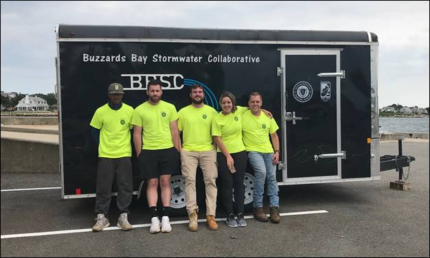
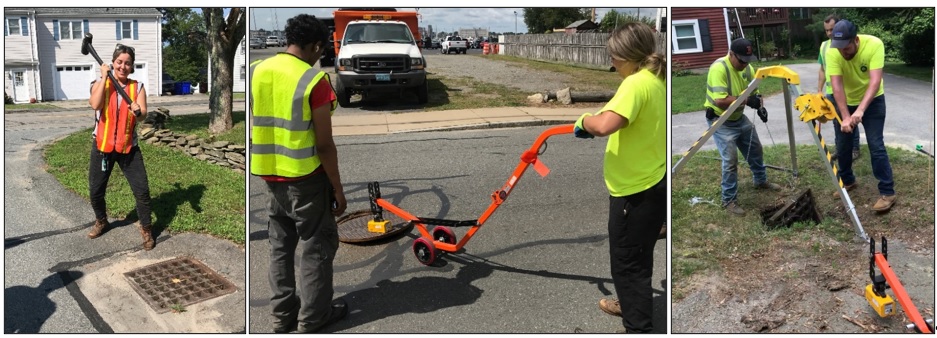
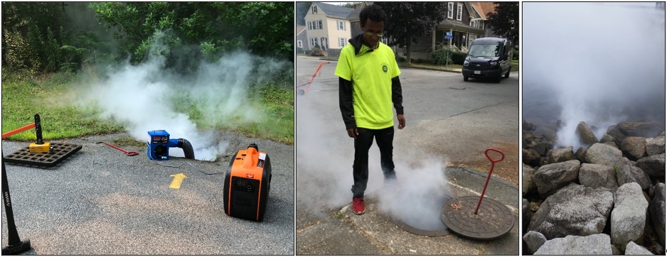
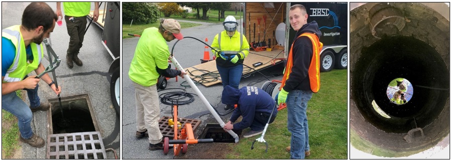
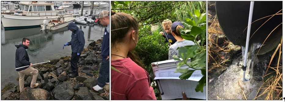
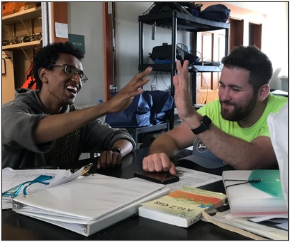
This past summer, now in its third year at the college, five new Stormwater Collaborative students joined the program. Some of these students will continue in subsequent semesters, or new students will join in the fall and spring sessions. Co-op students in the Stormwater Collaborative are taught a variety of skills including the use of GPS equipment, geographic information system software, laboratory testing of water samples, use of field monitoring test equipment, and learning how to collect samples from stormwater networks, and inspect stormwater networks with remote cameras. The photos below illustrate some activities and tasks undertaken by the students. All photos credited to Maura Flaherty, MMA.
In 2019, MMA received a grant from Massachusetts DEP to outfit a trailer with equipment and supplies to undertake field investigations. The NEP guided the design and selection of equipment in the trailer.Students, under the guidance of municipal and program staff learn how to safely access stormwater networks to inspect them and collect water samples for testing. Left: loosening a catchbasin with a sledge. Middle: removing a manhole cover with a magnetic lift. Right: winching a fallen catchbasin cover.The students may use a smoke machine to determine network connectivity or to locate an obscured outfall pipe.After access is achieved, a hand operated clam shovel (left) may be used to clear debris from the catchbasin to observe pipe connections or to collect water samples from connected pipes. A water jet (middle) may be used to clear connecting pipes. Water samples are collected during dry weather and wet weather flows.While the stormwater system is accessible, the students conduct inspections and may deploy a video camera.Students also collect samples from pipe discharges, some of which are difficult to access.Training also includes learning to conduct water quality tests using field meters (middle) and benchtop kits (right). The students also bring samples to certified laboratories for analysis of contaminants, such as bacteria.The program also trains students on the use of field survey and GPS equipment, and the students record numerous field observations.The students are trained on basic ArcGIS software skills, like data entry and georeferencing engineering plans, to produce maps they can use in their field work.Through the Stormwater Collaborative, participating Massachusetts Maritime Academy students are learning many skills that they can use in their careers.
The Buzzards Bay National Estuary Program is seeking proposals for its next round of the Buzzards Bay Watershed Municipal Mini-Grant Program. There is $110,640 available. Projects (up to $45,000 per project) must implement a recommendation(s) in the Buzzards Bay Comprehensive Conservation and Management Plan to protect and restore water quality and living resources in Buzzards Bay and its surrounding watershed. Eligible projects include stormwater remediation designs for discharges affecting marine waters, wetland/open space/habitat acquisition, migratory fish passage restoration, construction of boat pumpout facilities, and many other activities that support the management plan. A 33 percent match of requested funding is required, and only municipalities are eligible to apply. For more information, to view the RFR, and download required forms, see our funding information page. Proposals are due by Tuesday, September 21, 2021, by 4:00 PM.
The Buzzards Bay NEP is continuing to support and collaborate with the Buzzards Bay Coalition and scientists of the Woodwell Climate Research Center, in studies of long-term salt marsh loss and climate resilience in Buzzards Bay. In June, the Buzzards Bay NEP provided field training on the use of elevation survey equipment (Leica Sprinter Barcode Leveler) to Coalition Interns about to embark on a new season of fieldwork in Buzzards Bay salt marshes. Also in June, the NEP and Buzzards Bay Coalition installed an NGS rod-type elevation benchmark at the Demarest Lloyd State Park (Barneys Joy) in Dartmouth. The salt marsh at Demarest Lloyd is one of 12 sites where historical trends of marsh loss is being documented by the NEP, and where detailed measurements of salt marsh elevation and vegetation will be monitored by the Buzzards Bay NEP for many years to come. In addition, two of the long-term sites are included in a study on the use of runnels as a potential management tool to mitigate interior marsh loss caused by standing water caused by ditching spoils. The Buzzards Bay NEP is providing GIS mapping and analytical support for both studies.
The photos and video below show the installation of a steel rod into the ground. Five-and-a-half four-foot stainless steel rods were needed at this site. A tube of concrete surrounds the top two feet of the rod and is covered with a lid, protecting the rod from frost heaves and disturbance at the surface. The position and elevation of the benchmark was subsequently documented with a GPS unit (bottom photo). Photos by Joe Costa.