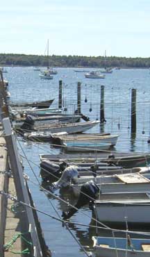
Boat Ramps & Boat Launches in Buzzards Bay
Click on a dot for more information about the site.Access Issues
Generally, boat ramps and launches that are owned by the State or Municipal government are open for use to any citizen of the Commonwealth. Municipalities, may however limit or preclude non-resident parking in municipal boat launch parking lots. Very rarely has a municipality restricted the use of a public facility like a boat ramp to residents only (e.g., theoretically you could use a ramp, then park at a friend’s house). We are aware of only one Buzzards Bay municipality that requires a resident sticker to use the Town’s ramp.
Fees
Very few state owned or municipal owned boat ramps charge a fee for the use of the ramp. However, municipalities often charge parking fees, or require beach parking stickers to park in boat ramp parking lots.
All state owned facilities, or municipal facilities that have been funded in part or whole by state funds, must provide equal access to all Massachusetts residents. That is, they cannot charge out-of-towners a higher use fee, or prevent use by non-residents (go to the Massachusetts Public Access Board Link below for more information on this). If a municipal ramp has not received state funds, theoretically a higher non-resident fee could be applied for use, but we are unaware of this practice, and there are probably complicated technical and legal issues precluding such a fee system.

Public Access to the Ocean
Private and municipal property in Massachusetts is typically owned to the low water mark, but lands below the low water mark are owned by the Commonwealth of Massachusetts. Moreover, Chapter 91 of the Massachusetts General Laws preserves the public’s right to fish, fowl, and navigate waters of the Commonwealth in the intertidal zone (between the high and low water marks), even if it is privately owned. This law does not convey the right to cross private property to reach these areas. All docks, piers, and boat ramps in Massachusetts require a Chapter 91 waterways license from DEP. As a condition of these licenses and their renewals, DEP now often requires that private marinas allow use of their boat ramps to the public, although they have a right to charge a fee for the use of the boat ramp. Not all private marinas have been required to allow public access to their boat ramps. Some Chapter 91 licenses provide for public access to intertidal areas.
For a more detailed explanation of these issues and public access rights, visit these Commonwealth of Massachusetts websites:
Massachusetts Coastal Zone Management’s Page on Public Access to the Shoreline
Massachusetts Department of Environmental Protection’s Chapter 91 Waterway Licensing Program
Massachusetts Public Access Board (DFWELE)
List by Watershed Town
Oil Spill Access Point Directions including Boat Ramps (pdf file)
(Printed driving directions to most Buzzards Bay boat ramps prepared by the BBAC for the Oil Spill Response Manual)
Bourne
- Barlow’s Landing (municipal) Mapquest ™ Map.
- Taylors Point Marina (municipal) Mapquest ™ Map.
- Buttermilk Bay Electric Avenue (municipal) Mapquest ™Map.
- Hen Cove (municipal) Mapquest ™ Map.
- Monument Beach (municipal) Mapquest ™ Map.
- Red Brook Harbor (municipal) Mapquest ™ Map.
Dartmouth
- Padanaram (municipal)
Fairhaven
- Pease Park, Middle Street (municipal) Google Map
- Seaview Avenue, Sconticut Neck (municipal) Google Map
Falmouth
- Childs River, Off Rte 28 (municipal) Google Map
- Falmouth Inner Harbor (municipal) Google Map
- Great Pond, Harrington Street (municipal) Google Map
- Green Pond, Menauhant Road (municipal) Google Map
- Megansett Harbor, County Road (municipal)Google Map
- Waquoit Bay, Seapit Road (municipal)
- West Falmouth Harbor, Old Dock Road (municipal) Google Map
- Great Harbor, Water St. Woods Hole (municipal)
Marion
- Island Wharf Town Dock (unpaved municipal, resident sticker required for parking) Google Map
- Aucoot Cove (private marina, for fee) Google Map
- Wings Cove Ramp (municipal, public, but resident parking only) Google Map
- Town Ramp (municipal) and Burr Brothers Ramp (private, but allows public use for a two dollar fee). These two ramps are very close together. There is no fee to use the Town Ramp, but there is no public parking available. Google Map
Mattapoisett
- Short Wharf, Water Street (municipal) Google Map
- Town Landing, Matt Neck Road (municipal)
Public Access Board map of state funded access points in Mattapoisett
New Bedford
- East Rodney French Boulevard, H Street (municipal)
- West Rodney French Boulevard (municipal)
Wareham
- East Boulevard, Onset (municipal)
- Maco’s, Rt. 6-28
- Oak St., Tempest Knob
- Rt 195 Eastbound rest area
Public Access Board map of state funded access points for the Wareham River Estuary
Public Access Board map of state funded access points for the Weweantic River Estuary
Westport
- Goosebury Island (state)
- Hix Bridge Landing (municipal)
- Rt. 88 Bridge Landing (municipal)
Boat Ramps funded in part by the Commonwealth of Massachusetts
Boat Sewage No Discharge Area Info
No Discharge Area Fact sheet for Buzzards Bay
Buzzards Bay No Discharge Area 1999 Press release
Buzzards Bay Boat Pumpout Locations
Important Numbers:
U.S. Coast Guard Station: Cape Cod Canal, Sandwich, MA 508-888-0020
U.S. Coast Guard Station: Woods Hole, MA 508-457-3253
Search & Rescue Emergencies: Cape & Islands – 457-3210
The Coast Guard Monitors Channel 16 (2182 kHz) & Channel 22 (157.1 mHz),
Call the Coast Guard on Channels 12 & 22