Hurricane Irene storm damage in Buzzards Bay, 28 August 2011
by Joe Costa
In Southeastern Massachusetts, the impacts of Tropical Storm Irene on New England will likely best be remembered for the power outages it caused, and the televised scenes of damage caused by exceptionally heavy rains west of the storm’s center and the resulting devastating inland river flooding in western New England. It will be less remembered for any coastal erosion it caused.
Hurricane Irene diminished to a tropical storm on the morning of August 28, 2011, just south of New York, and the center moved into New England near the New York – Connecticut border, destroying dozens of homes on the Connecticut coast. Despite the diminished tropical storm force winds, the storm still left a strong mark on many Buzzards Bay coastal communities due to the size of the storm, the widespread and persistent gale force winds throughout the day and into evening, coupled with elevated tide levels. The more than 18 hours of gale force winds also resulted in widespread power outages throughout southeastern Massachusetts and Cape Cod.
The coastal damage and tidal flooding reported by Buzzards Bay coastal communities was equal to or exceeded the damage caused by some recent memorable nor’easters. The western shore of Buzzards Bay, being closer to the New York landfall of Irene, experienced the most rain and highest winds, although 60 plus knot wind gusts were reported as far east as Hyannis. The amount of rain rapidly diminished west to east, and total rainfall amounts were low in Falmouth and eastward across Cape Cod, with most areas receiving less than an inch of rain, and the sun breaking through the clouds for some periods in the morning.
The Towns of Falmouth and Westport had the most significant coastal erosion and overwash of roads among Buzzards Bay municipalities, with East Beach Road in Westport being the hardest hit. Generally, south-facing exposed shorelines were most affected. Only a few boats lost their moorings and were washed ashore.
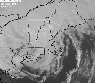
Satellite IR image of Tropical Storm Irene, with the large remnant eye of the storm centered over southern New York and western Connecticut.
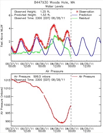
WHOI’s real-time tidal gauge and air pressure data as Tropical Storm Irene passed through New England. Click on the graph to enlarge it.
The storm coincided with a period of spring tides that occur every 4 weeks with tides somewhat higher and lower than normal. However, for most Buzzards Bay communities, the storms lowest air pressure (which helps raise water levels), and the strongest winds and wave actions occurred during the lower than normal low tide in the afternoon (note graphs from NOAA buoy BUZM3 below). Winds gusts peaked at around 50-55 knots in the early afternoon on Sunday at NOAA buoy BUZM3 at the mouth of Buzzards Bay (below). Still, the storm caused noticeably higher than normal tides, but as shown by the graph of tidal elevation over predicted for Woods Hole (right), the highest tidal elevation in Buzzards Bay occurred at 8 in the morning when the storm was approaching, and not at 8 PM that night, when the storm had already passed, air pressure had increased appreciably, and winds were somewhat diminishing (note the discrepancy between the observed and predicted tides is the green line).
An exception to the timing of impacts of the storm occurred along the south coast of Falmouth. This is because tides in this area (and east towards Hyannis) are intermediate in time between the Newport RI tidal regime and the Boston, MA tidal regime. Not only are tide times intermediate in this area, but tidal range is considerably dampened, with a tidal range of only 1-2 feet. This contrasts to the 8-10 foot tides on the north side of Cape Cod, and 3-4 foot mean tidal ranges typical in Buzzards Bay. The peak of the storm and lowest air pressure in Falmouth coincided with the noontime high tide in East Falmouth. This is evident in the photo below of the pedestrian path at Little Pond near Falmouth Heights beach, with the water surging just below the base of the footbridge), and at Edwards Boat yard at the head of Eel Pond on the Child’s River, where the docks and a portion of the parking lot were inundated.
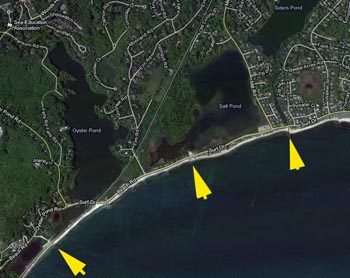
The day after the storm, storm damage was most apparent on the south-facing coasts of Westport and Falmouth. In Falmouth, although the midnight tide may not have been as high as the early afternoon tide, both tides, coupled with the non-stop gale force winds helped overtop many sections of shore roads, including Menauhant Rd, Surf Drive, and the Shining Sea Bikeway near Nobska Point, leaving behind tons of sand and cobble that the Falmouth DPW was quickly removing on Monday morning. The entrance way of two small coastal ponds were completely blocked off (Fresh River, the entrance to Siders Pond, and the entrance to Salt Pond), with a third, the Trunk River (the entrance to Oyster Pond), being partially blocked.
Westport sustained the worst damage, with areas asphalt on East Beach Road completely torn up.
One Hurricane-like effect is becoming apparent after the storm. Communities on the east side of an eye get little rain, and a lot of saltwater spray is blown inland. This is already causing leaf burn, and many trees in the coastal zone around will lose their leaves before the onset of fall.
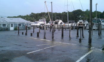
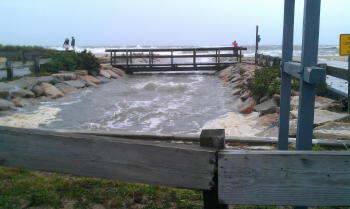
Left: Tidal inundation at Edward’s Boatyard, in upper Eel Pond / Childs River in Waquoit. Photo Credit: Joe Costa. Right: Elevated tides surging under the walkway into Little Pond, Falmouth, near Falmouth Heights about 12:20 PM on Sunday. Based on debris patterns evident the next day, waves topped this footpath. Photo credit: Maureen Costa. Click images to enlarge.
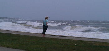
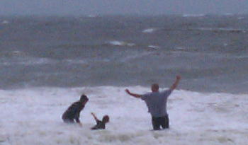
Left: Observing the storm surf near Falmouth Heights. Click image to enlarge. Right: Family day at the beach. Photo credits: Maureen Costa
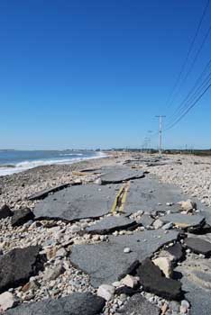
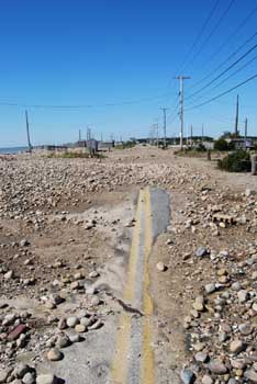
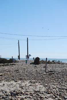
Left: View of destroyed East Beach Road in Westport. Middle: Debris Covered East Beach Road. Right: Damage to a trailer lot along East Beach Road.
Click images to enlarge. Photo credits: Mitch Ziencina
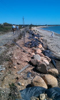
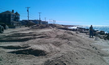
Left: Resulting erosion and overwash on the Shining Sea Bikeway near Oyster Pond and Nobska Point. Click image to enlarge.
Right: Sand being pushed off Menauhant Rd, back onto the beach. Photo Credits: Joe Costa.
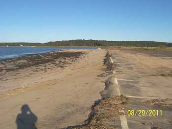
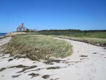
Left: Washover at the Little Harbor Beach parking lot in Wareham. (photo credit: Rebecca Haney).
Right: Small break-through in the dune at Great Sippewissett Marsh. (photo credit: Pam Truesdale) Click images to enlarge.
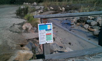
Left: Sand has partially filled the Trunk River, entrance to Oyster Pond. Click image to enlarge.
Right: Google map showing the entrances of Oyster Pond (estuary), Salt Pond (estuary), and Siders Pond (fresh, salt stratified).
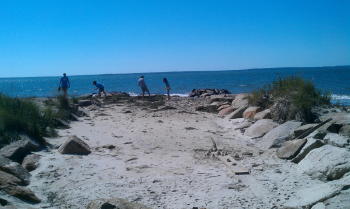
Sand and cobble has completely filled in the entrance to the Fresh River between the channel groins along Falmouth’s Surf Drive. Photo Credit: Joe Costa.
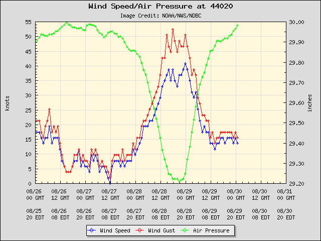
Wind Speed and air pressure recorded at NOAA buoy BUZM3 at the mouth of Buzzards Bay.
Links
Herald News: Westport Roads chewed up.
News from FEMA
FEMA’s Private Sector Desk is operational from 8am-8pm daily and can be reached at FEMA-NRCC-Private-Sector@dhs.gov or by calling 202-212-2240.