Historical Eelgrass Abundance: East Cove of West Island
Note: The data and maps on this page will be included in a forthcoming report summarizing changes in eelgrass distribution in Buzzards Bay. The information is posted here to facilitate review of the information, but the data should be considered to be in draft form and subject to change.
Summary
Eelgrass in East Cove of West Island in Fairhaven provides an excellent reference site for an undisturbed, unpolluted embayment. Early photographs suggest that eelgrass was absent for most shallow areas in 1951, and this was one of several sites where photos of eelgrass colonization was evaluated in Costa 1988a+b to develop a computer model of eelgrass colonization. As described below, the 1951 eelgrass maps developed by DEP for this site appear to be inaccurate and based on a misinterpretation of the available aerial imagery. Probably due to the geographic isolation of this site, and prevailing southwesterly winds, eelgrass may have been absent from the shallow areas of this cove since the 1933 wasting disease until the apparent first colonization in 1951.
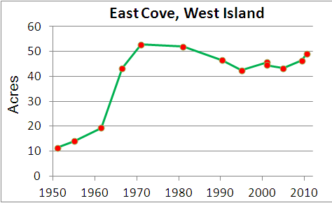
Acres of eelgrass in the inner portion of East Cove (see boundary line below) of West Island over time.
Mooring and Boating Impacts
There are no boat moorings or docks in this embayment.
Previous Summaries
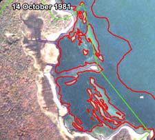
Costa (1988a+b) mapped the colonization of eelgrass at this site from the near absence of beds in the early 1950s, to dense colonization by the early 1980s. He also recorded beach erosion rates and showed that beach erosion at eight stations were less in the period of high eelgrass abundance than during the 1950s.
West Island Cove Eelgrass Historical Analysis
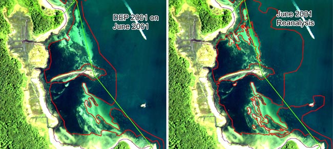
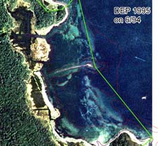
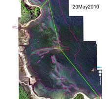
Some of the mapped eelgrass boundaries developed by DEP, and posted on the MassGIS website, are overly generalized for the purposes of evaluating patterns of eelgrass cover in some embayments in Buzzards Bay. This was the case East Cove on West Island, where eelgrass bed boundaries were both overly generalized and included large bare areas. New Eelgrass coverages were developed using aerial photographs from various sources, which were georeferenced, image enhanced, and heads up digitized in ArcMap 9.3. As illustrated by the photograph below, DEP’s 2001 eelgrass coverage was replaced with the new 2001 coverage (below right). Similarly, eelgrass coverages digitized by Costa in the 1980s from aerial surveys lacked the fineness of detail and georeferencing achievable with software today, so that that study’s original source photographs reanalyzed.
DEP 2001 eelgrass boundary versus 2001 BBP reanalysis for this study. The base photo coverage was the original one used by DEP for their mapping. For the BBP reanalysis, spring 2001 MassGIS orthos and bathymetric maps were used for establishing outer boundary areas. The green line represents the boundary of the inner cove area studied for eelgrass cover changes over time.
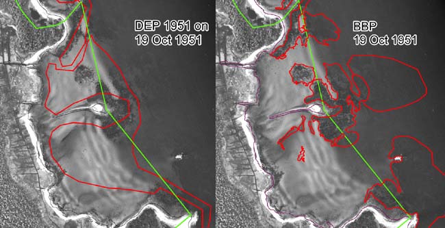
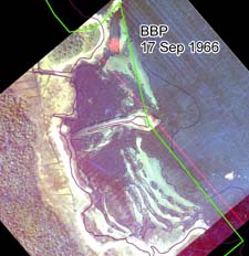
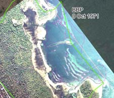
DEP’s 1951 eelgrass maps in some embayments are somewhat generalized, and often include large bare areas. This coverage was never officially released, but is used by the Massachusetts Estuaries Project to help determine baseline eelgrass cover. In East Cove, West Island, DEP’s 1951 coverage shows eelgrass widespread (below right). The primary polygon area shown in the DEP coverage was characterized as: “density=moderate, coverage=patchy, and confidence=high.” Costa’s 1988 found eelgrass largely lacking in his October 1951, but found eelgrass rapidly recolonized the area in the 1950s and 1960s. These photographs were reanalyzed for the analysis presented here, and eelgrass is lacking in the 1951 photograph, and eelgrass did rapidly colonize the area in the 1950s and 1960s as shown in the photographs below.
The rejected DEP 1951 eelgrass boundary (left) versus the 1951 BBP reanalysis for this study. Click image to enlarge. The DEP GIS data set characterized this bed as having moderate density, patchy coverage, and high reliability in identification.
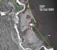
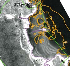
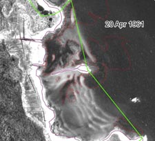
As illustrated in the detailed image below, small circular eelgrass beds <2-10 feet in diameter were apparent in the cove in the 1951, and these were expanding appreciably by 1961. Note that eelgrass was abundant in the north end of the cove by 1961, and by 1966, eelgrass dominated most of the shallow portions of the cove. 
Detail of a small area of the cove in October 1951 and April 1961 (showing 1951 bed positions). Beds both expanded and migrated with shifting sand waves. Click image to enlarge.
Photo dated 19 October 1951 showing eelgrass in East Cove West Island, Fairhaven, as interpreted by the Buzzards Bay NEP.
Photo dated 20 April 1961 showing eelgrass in East Cove West Island, Fairhaven, as interpreted by the Buzzards Bay NEP. Note the expansion of the eelgrass bed at the north end of the cove in the 1951, 1956, and 1961 aerial photographs.
