The Buzzards Bay NEP has introduced four new interactive maps in support of the Buzzards Bay Stormwater Collaborative. Instead of one online map we have two online maps and two online dashboards. The new mapping products are available at stormwater.buzzardsbay.org/newmap.html.
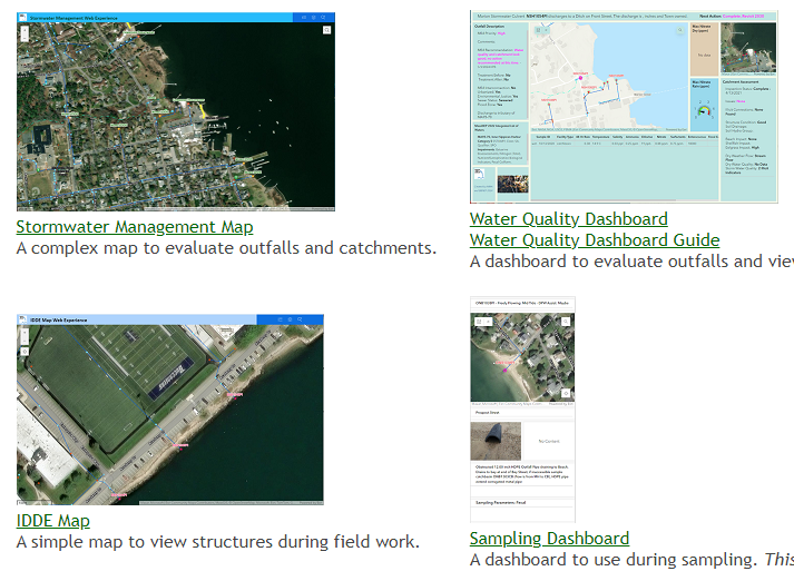
A Stormwater Management Map provides a diverse array of overlays to help municipal staff and managers to evaluate stormwater outfalls and their catchments. It shows the status of IDDE investigations and provides strategies for MS4 initiatives. A Water Quality Dashboard displays water quality sampling data collected from dry weather and stormwater discharges. This dashboard provides details and recommendations for the catchment. An IDDE map shows less details and is designed for field work and to display well both in the office and the field. Finally, a Sampling Dashboard is meant for use on smart phones and supports field investigations. The map products were developed and designed by Buzzards Bay NEP stormwater Specialist Kevin Bartsch. In August, the NEP will host a 45-minute webinar to demonstrate the new online maps. Reach out to Kevin if you would like to attend.