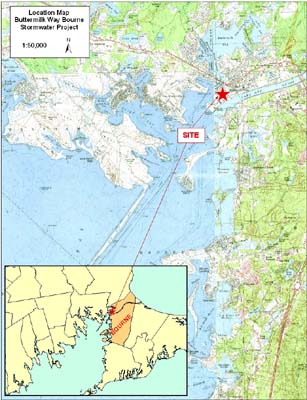
Information about the Buttermilk Way Stormwater Engineering procurement
Stormwater treatment and shellfish bed opening at Cohasset Narrows in Bourne, MA
Last update: May 13, 2015
In partnership with the Town of Bourne, and as part of our municipal grant program, in September 2011 the Buzzards Bay NEP committed $20,000 to the Town of Bourne for design services in anticipation of providing engineering services to assist the town develop stormwater treatment designs to reduce stormwater volumes and pollutants associated with a discharge to Cohasset Narrows near the mouth of Buttermilk Bay. In April 2012 the BBNEP posted a Request for Responses for engineering services to assist the Town of Bourne develop stormwater treatment designs to reduce stormwater volumes and pollutants discharging contributing to water quality impairments in Cohasset Narrows. The Request for Responses (RFR) was posted April 12, 2012, the application due date was Friday, June 1, 2012 by 4:00 PM, and Green Seal Environmental Inc. of Bourne, MA, with a bid of $18,000, was selected to provide the services. The company’s work commenced at the end of July 2012 and was finished by December 2012. The BBNEP oversaw and administered the engineering contract on behalf of the Town of Bourne. The original RFR is available on the CommBuys website.
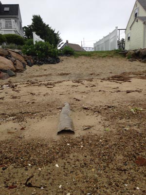
Since construction of the stormwater treatment systems, this pipe no-longer discharges.
Even before the designs were finalized, the Town of Bourne sought construction funds from Massachusetts CZM’s Coastal Pollutant Remediation program. In 2013, CZM was only able to commit $24,013 to start the work on the town’s portion of the project and encouraged the town to seek additional funds in the subsequent year funding for a second phase of work involving the parking lot at Massachusetts Maritime Academy. The town sought additional funds and received an additional $125,000. The second phase of work also involved contributions from Mass Maritime Academy, and the total cost of this project is estimated at $225,000. During 2013 and 2014 the project was worked on and the entire project was completed in June 2014. After some visual inspections of the discharge after some severe storms, the town realized that the infiltration capacity of the system was so great, that even after a 5.9 inch rainstorm in July 2014, no stormwater was discharged from the pipe on the beach. As a result of this performance and water quality mornitorng along shore, in December of 2014 DMF re-opened the 1.2-acre shellfish area in front of the discharge. The shellfish growing, designated BB43.5 by DMF, had been classified as “prohibited” since 1994. While the opening was modest in size, the project clearly illustrates the benefits of the installation of stormwater treatment systems.
Background
In 2011, the Town of Bourne sought to treat a stormwater discharge to Cohasset Narrows near the entrance of Buttermilk Bay. Portions of the narrows are currently permanently closed to shellfishing due to various sources of pathogens. The Town of Bourne and the Buzzards Bay NEP recognize that water quality improvements will be achieved only through the systematic treatment or elimination of many sources that discharge bacteria to the area.
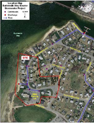
The focus of this remediation effort is to reduce stormwater volumes and bacteria discharges associated with one discharge pipe shown on the locus map below right. The Buzzards Bay NEP expects to make available $20,000 in federal funds to hire an engineering or environmental service firm. The selected firm will produce stormwater designs for the Town of Bourne that reduce stormwater discharge volumes and pollutants from this site.
In our original posting we wrote:
Designs may include infiltration biofilters, or various other LID techniques. The Buzzards Bay NEP staff will work with the selected vendor, Bourne Board of Selectmen, Conservation Commission, Department of Natural Resources (applicant), and the Bourne Highway Department to decide upon the most practical and cost effective stormwater management solution given the constraints of the sites. After final designs are complete, the BBNEP will work with the Town of Bourne to obtain funding for the construction of the stormwater designs.
A Bidders Conference was held at 10:00 AM on Tuesday, May 15, 2012 in the Massachusetts Maritime Academy parking lot at 11 Buttermilk Way in Bourne, MA (shown on the locus map, formerly the Beachmoor Inn). On May 16, this page was updated with questions received at the bidders conference and tentative responses, engineering plans for a sewer project that were prepared for the town in 1989, and an additional digital elevation model file of the study area obtained from the USDA NRCS-USGS NELIDAR project. This elevation data is in a georeferenced img file. The bidders conference handout summarizing this project is provided in this pdf file: bidders-conference-bourne-may-2012.pdf. We are also making available the bidders conference attendance list.
Proposal Excerpts
[referenced figures not shown]
Background
The area of concern has been closed to the harvesting of shellfish for decades. There are six connected catch basins that drain into a section of Butler Cove, aka Cohasset Narrows, through a culvert located at the end of the public beach way at 11 Buttermilk Way. There is also a seventh catch basin located at 35 Buttermilk Way that is not connected and when full, flows down Buttermilk Way to the catch basin located at 23 Buttermilk Way. The discharge area has unacceptable levels of fecal coliform as determined by the Massachusetts Division of Marine Fisheries (DMF) which results in the area being closed to all shellfishing. The closed area is populated with both soft shell clams and quahogs. To the immediate north of the closed area is a town designated oyster bed known as the “Taylor Point” oyster bed. To the immediate south of the closed area is another area that Bourne routinely uses as a transplant area for the Division of Marine Fisheries Contaminated Relay Program. This area was closed on April 25, 2011 and received approximately 514 bushels of quahogs harvested from the Taunton River in Swansea. We anticipate re-opening this propagation area to the harvest of shellfish sometime in October.
Expected environmental benefits of proposed work
We would expect the remediation of this drainage system would resolve the issue of fecal coliform entering the watershed. Successful completion of this project would hopefully result in DMF reclassifying the area to an open status for the harvesting of shellfish. The Town of Bourne is willing to collect samples of stormwater discharges. The town does own land for site remediation and will consider if necessary BMPs that may require the road be dug up. We would prefer there was not a reduction in road width. The Town of Bourne will dig test pits at its expense. The Town of Bourne will also provide at its expense copies of town plans, engineering as-builts, and any other existing pertinent information needed to assess the project. The Town of Bourne’s project lead will participate in necessary site visits and meetings to develop a conceptual stormwater remediation plan for the site. Water and gas lines are located near the remediation site. The town will work with the utility companies if needed to resolve any issues that may arise. Should this project be selected for the development of final designs and engineering plans, the Town of Bourne agrees to have representatives from the Conservation Department and the Department of Public Works available to meet with the Buzzards Bay NEP and private engineer to finalize designs for the project.
If final design and engineering plans are developed for this project, the Town of Bourne will welcome any assistance from the Buzzards Bay NEP with the preparation of a grant application to fund the implementation of the plans.
Questions Received and Responses to this RFR
Questions received (which may be paraphrased), and answers to those questions. These responses should be considered tentative, and for informational purposes, and will not be finalized until the Question period ends.
Question 1: Is the SBPP-participating business language in Section (1)(J) of the RFR just a goal or a requirement, and must a vendor be a Small Business Purchasing Program (SBPP)-participating business to submit a proposal under this RFR?
Response to Question 1: It is not required that a vendor be a SBPP-participating business to apply, but it is a requirement (pursuant to Executive Order 523) that our program first evaluate bid responses from SBPP-participating businesses), and award the contract to the highest ranking SBPP-participating business that submits a bid that meets or exceeds the solicitation criteria. If determined that there is no SBPP bid that meets or exceeds the solicitation criteria, or if no SBPP-participating vendors provide a responsive bid, then the Department will evaluate and award bid responses received from non-SBPP businesses.
To determine eligibility and to participate in the SBPP, please review the requirements and general program information at www.mass.gov/sbpp. The Buzzards Bay NEP strongly encourages all eligible bidders to register in this program.
Question 2: There is a leaching catch basin with no overflow that is located on Buttermilk Way just north of the drainage area, but it is not included in the RFR. If designs were proposed to include this catch basin, would such proposals be considered more favorably?
Response to Question 2: Proposals that include this basin, or other value added elements will be weighted favorably on the scoring sheet under grading criteria #1 (Description of the Approach to the Proposed Work).
Question 3: Should the drainage from the Massachusetts Maritime (MMA) building and parking lot be included in the drainage calculations and what are the future plans for the facility and parking area?
Response to Question 3: MMA is a partner in this project and is willing to allot a portion of their parking lot for a treatment system. Design options must be discussed with and approved by MMA before designs are finalized. Their environmental program staff may want to use the stormwater treatment systems as a teaching opportunity. The school at some point may remodel the building and resurface the parking lot, but this will be likely after any stormwater treatment systems are installed.
Question 4: Is managing impervious runoff from homes, such as from downspouts in this watershed, part of the stormwater design?
Response to Question 4: Yes, all impervious contributions in this watershed should be included in the design of the stormwater from this site. Management practices could include recommending homeowner action such as installation of drywells to capture most roof runoff, for example, but the design should be based on no landowner participation.
Question 5: Is the catch basin at the south end of the MMA parking lot part of the designs?
Response to Question 5: No. That system has an infiltration system and no overflow discharge and is not part of the designs.
Question 6: What is the extent of the shellfish bed closure and is it rainfall conditional or seasonal.
Response to Question 6: The closure area is indicated on the map in the RFR. It is year round, and not seasonal and is not rainfall conditional.
Question 7: Does the Buzzards Bay Coalition have a monitoring station nearby?
Response to Question 7: The Coalition, which tests for nitrogen related contamination, does not have a monitoring site at this location. Their nearest sampling site is Butler Cove. If you are interested in bacterial data for the waters off Buttermilk Way, they may be available from the Mass Division of Marine Fisheries.
Question 8: Where can I download lidar data related to this project?
Response to Question 8: The BBNEP has available for download 2 ft contour shapefiles based on lidar data sets on this page: climate.buzzardsbay.org/firm-sfha.html. The file is called fema_09_plymouth_so_2ftlidar.zip. The digital elevation models for this site are at buzzardsbay.org/bourne-engineering-procurement-cohasset-narrows.htm. Other state and federal agencies may have lidar data, but the Buzzards Bay NEP has not undertaken an inventory of sources.
Available Data and Maps
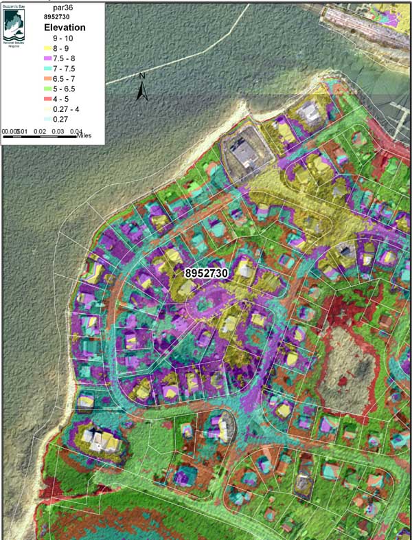
Image based on 2007 Lidar data. Click image to enlarge
The above false color file was created with this 2007 lidar survey GIS digital elevation TIN model file (tnz_8952730.zitnz_8952730.zip; 26 MB) in ArcView. Information about the 2007 LIDAR survey can be found on our FEMA and LIDAR information page, where we also post 2 ft contours based on the 2007 lidar data.
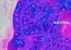
2011 Lidar image of Buttermilk Way watershed Click image to enlarge
The BBNEP has also received a 2011 LIDAR data set from USDA NRCS/USGS. Download this Georeferenced Imagine Format file with elevation data (19_03644622.zip) 9 MB zipped file that can be displayed in ArcView and other programs. Information about available data at our FEMA and LIDAR information page.
1989 Bourne sewer plan, scan #1 (sewer_20120516_0001.pdf) 1 MB pdf file.
1989 Bourne sewer plan, scan #2 (sewer_20120516_0002.pdf) 1 MB pdf file.
2012 USDA/NRCS Soils Investigation USDA/NRCS 1.8 MB pdf file, investigation conducted by Glenn Stanisewski, Resource Soil Scientist, USDA-NRCS, West Wareham, MA.
For more information on this project contact: Sarah Williams
