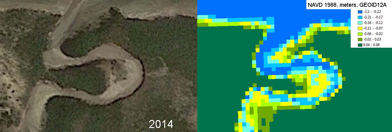
Left: Spring 2014 image of a portion of the marsh at the West End of Provincetown harbor behind the breakwater. Right: LDAR image circa 2013 or 2014 of the same are showing pixel elevations in NAVD 88 meters (Geoid12A).
Left: Spring 2014 image of a portion of the marsh at the West End of Provincetown harbor behind the breakwater. Right: LDAR image circa 2013 or 2014 of the same are showing pixel elevations in NAVD 88 meters (Geoid12A).