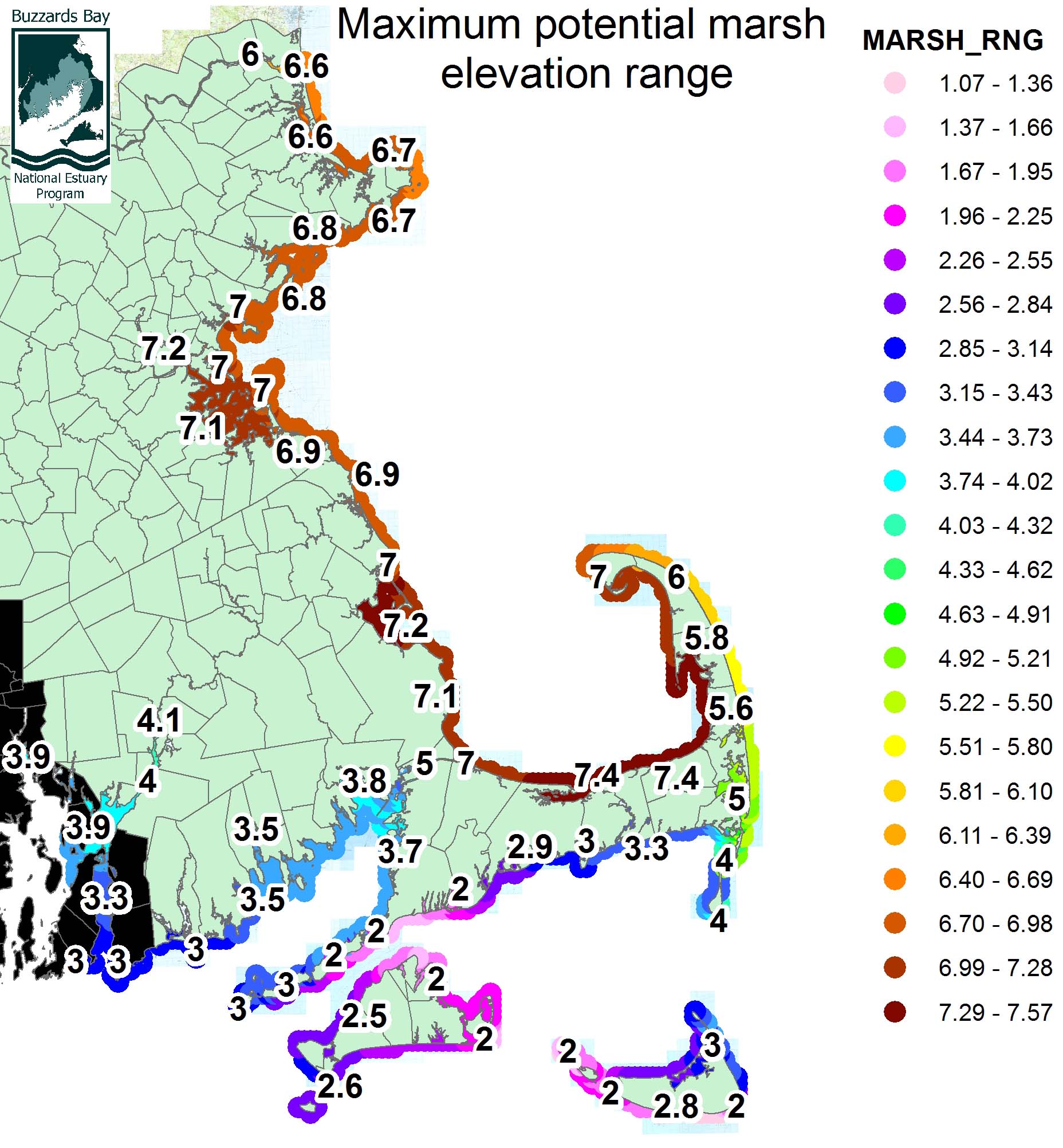
Predicted maximum potential elevation range (in feet) of salt marshes around Massachusetts. The range was calculated by the equation Marsh Range = HTL – LMSL as defined in the other maps. See our low marsh boundary page for more information about variability in the range of the low marsh boundary.