Related Pages: Tidal Datums | Salt Marsh Expansion with SLR | Atlas of Tidally Restricted Salt Marshes | Tidal Datum Viewer | Salt Marsh Lower Boundary Elevation | Interactive map of marsh monitoring sites | Migrating salt marshes | Tidal Elevations and Datums in Buzzards Bay |
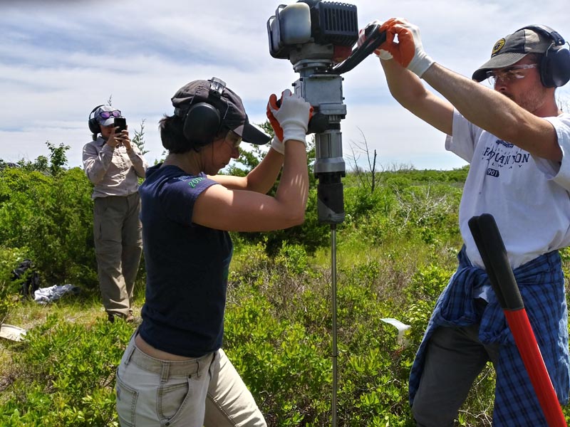
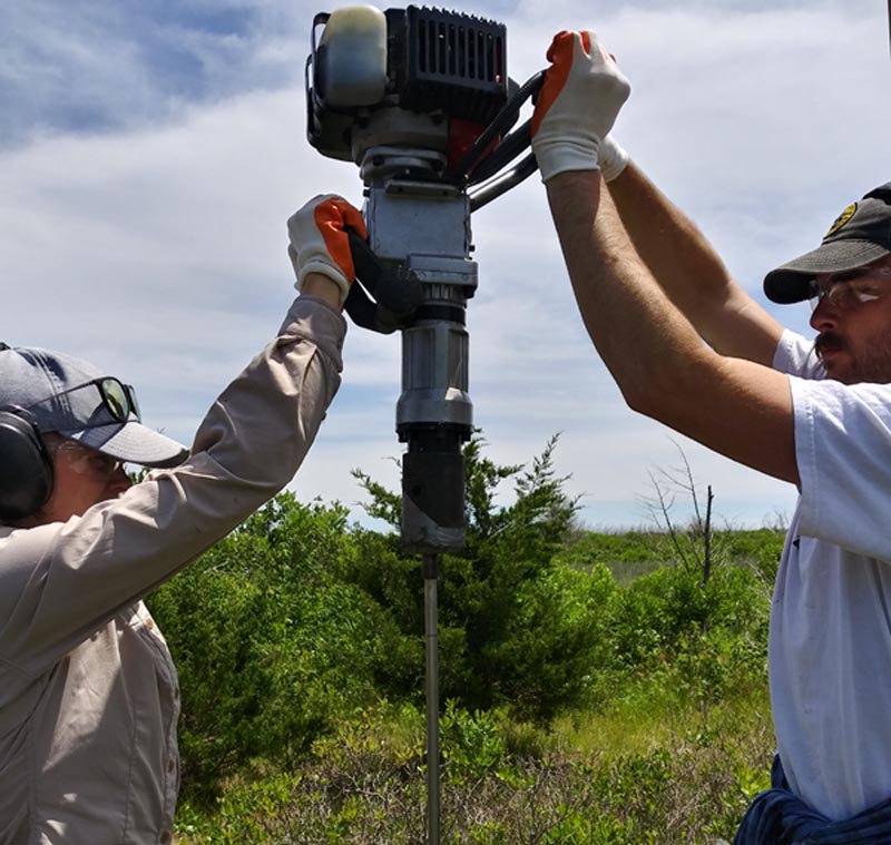
The Buzzards Bay NEP is continuing to support and collaborate with the Buzzards Bay Coalition and scientists of the Woodwell Climate Research Center, in studies of long-term salt marsh loss and climate resilience in Buzzards Bay. In June, the Buzzards Bay NEP provided field training on the use of elevation survey equipment (Leica Sprinter Barcode Leveler) to Coalition Interns about to embark on a new season of fieldwork in Buzzards Bay salt marshes. Also in June, the NEP and Buzzards Bay Coalition installed an NGS rod-type elevation benchmark at the Demarest Lloyd State Park (Barneys Joy) in Dartmouth. The salt marsh at Demarest Lloyd is one of 12 sites where historical trends of marsh loss is being documented by the NEP, and where detailed measurements of salt marsh elevation and vegetation will be monitored by the Buzzards Bay NEP for many years to come. In addition, two of the long-term sites are included in a study on the use of runnels as a potential management tool to mitigate interior marsh loss caused by standing water caused by ditching spoils. The Buzzards Bay NEP is providing GIS mapping and analytical support for both studies.
The photos and video below show the installation of a steel rod into the ground. Five-and-a-half four-foot stainless steel rods were needed at this site. A tube of concrete surrounds the top two feet of the rod and is covered with a lid, protecting the rod from frost heaves and disturbance at the surface. The position and elevation of the benchmark was subsequently documented with a GPS unit (bottom photo). Photos by Joe Costa.