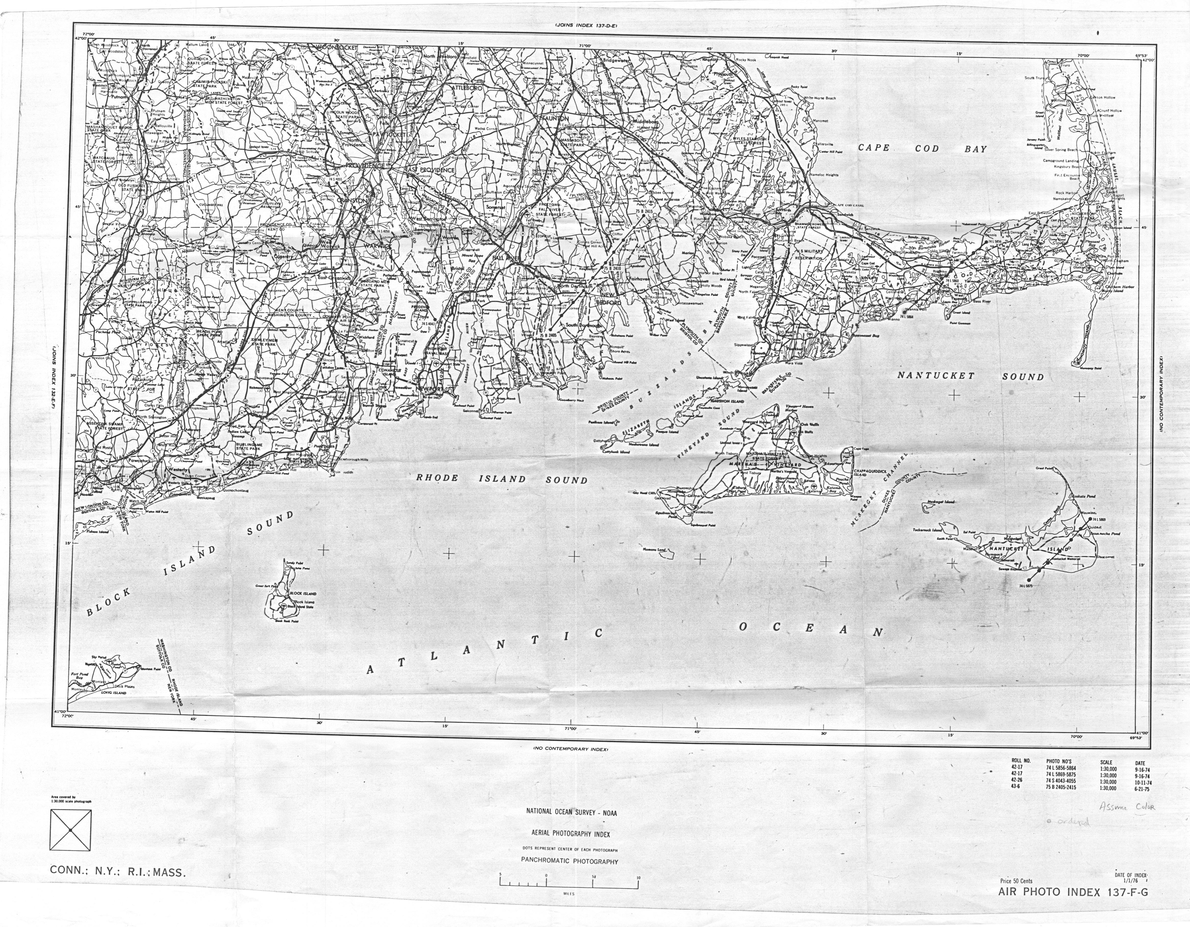
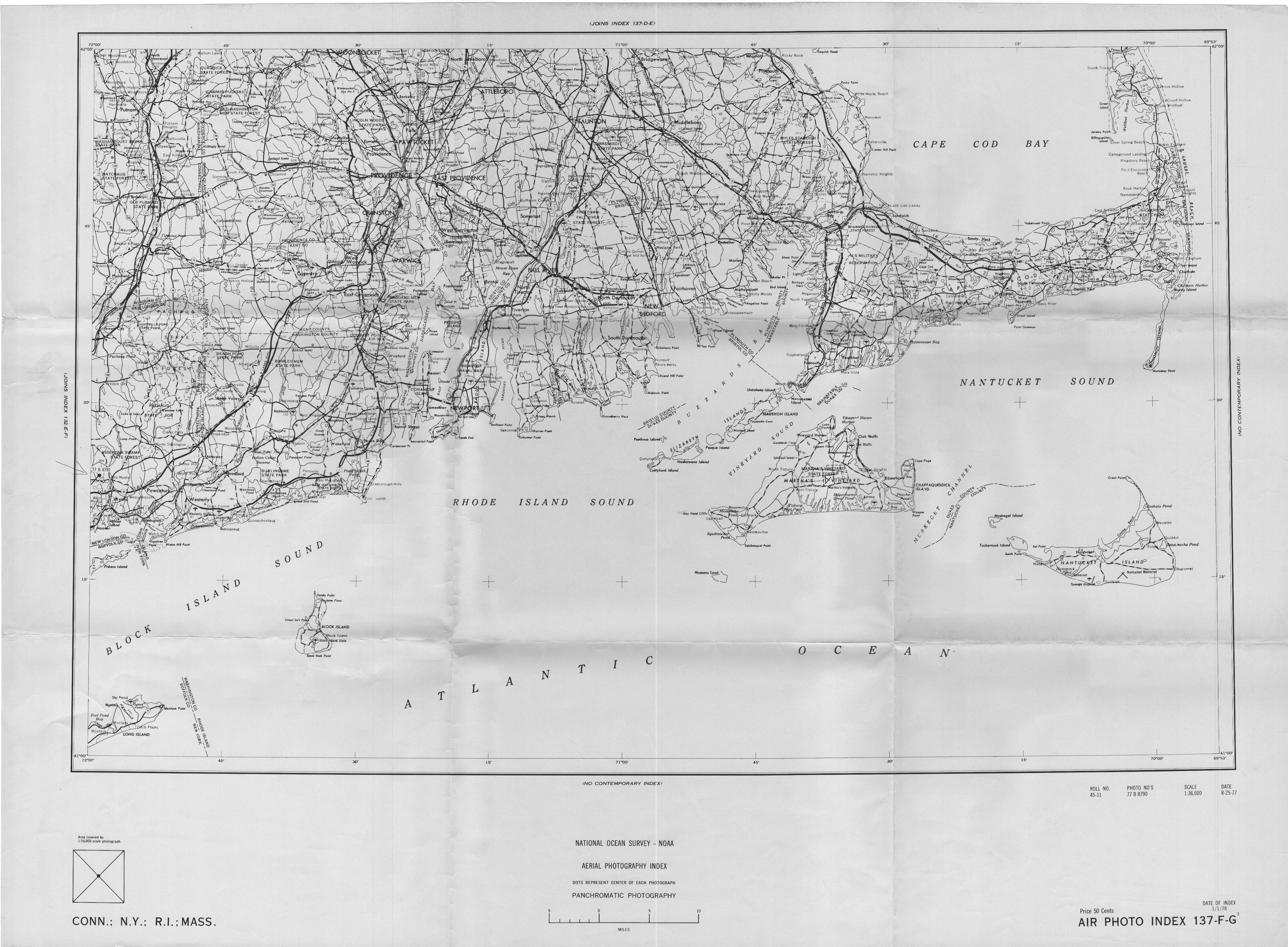
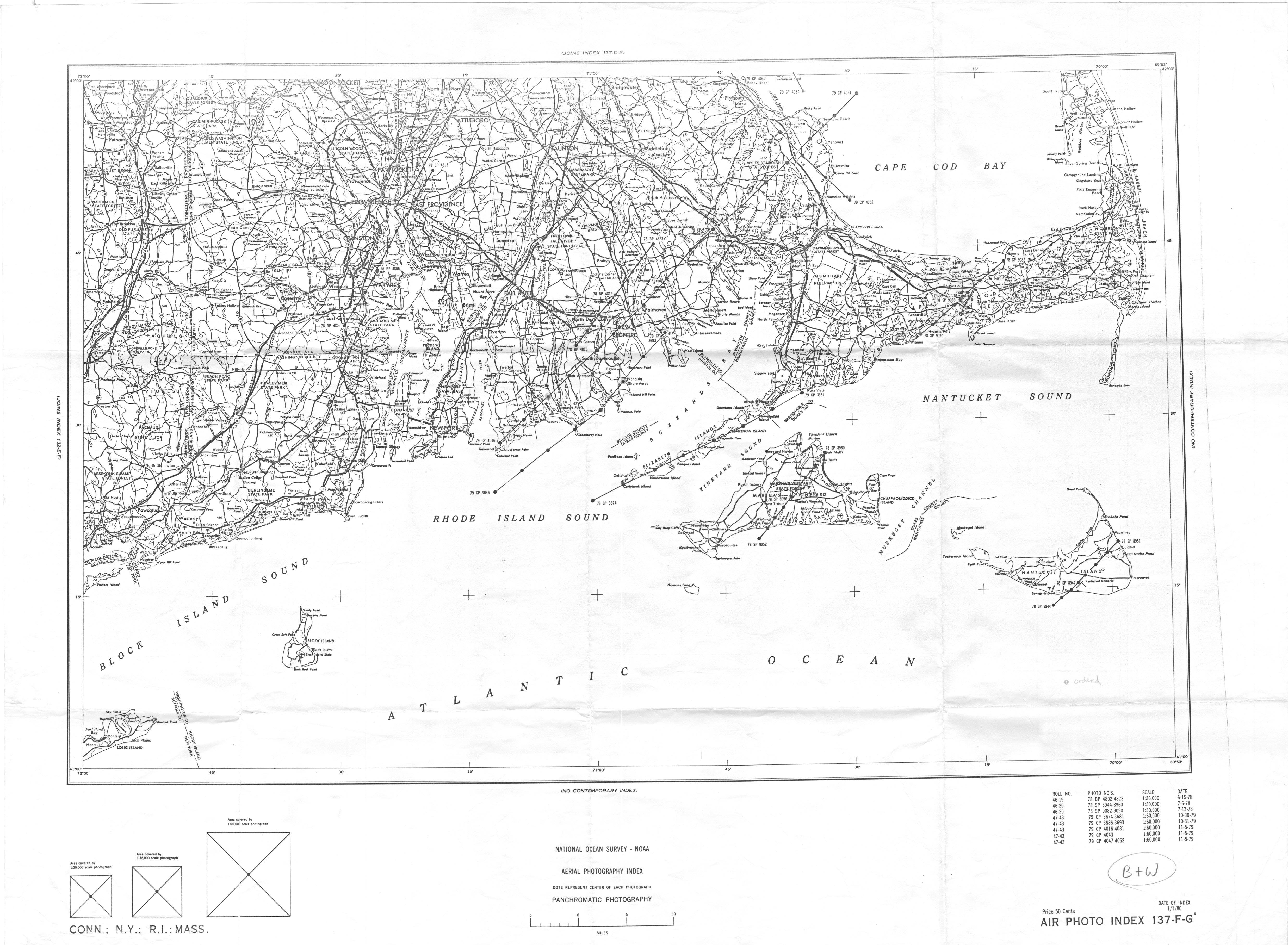
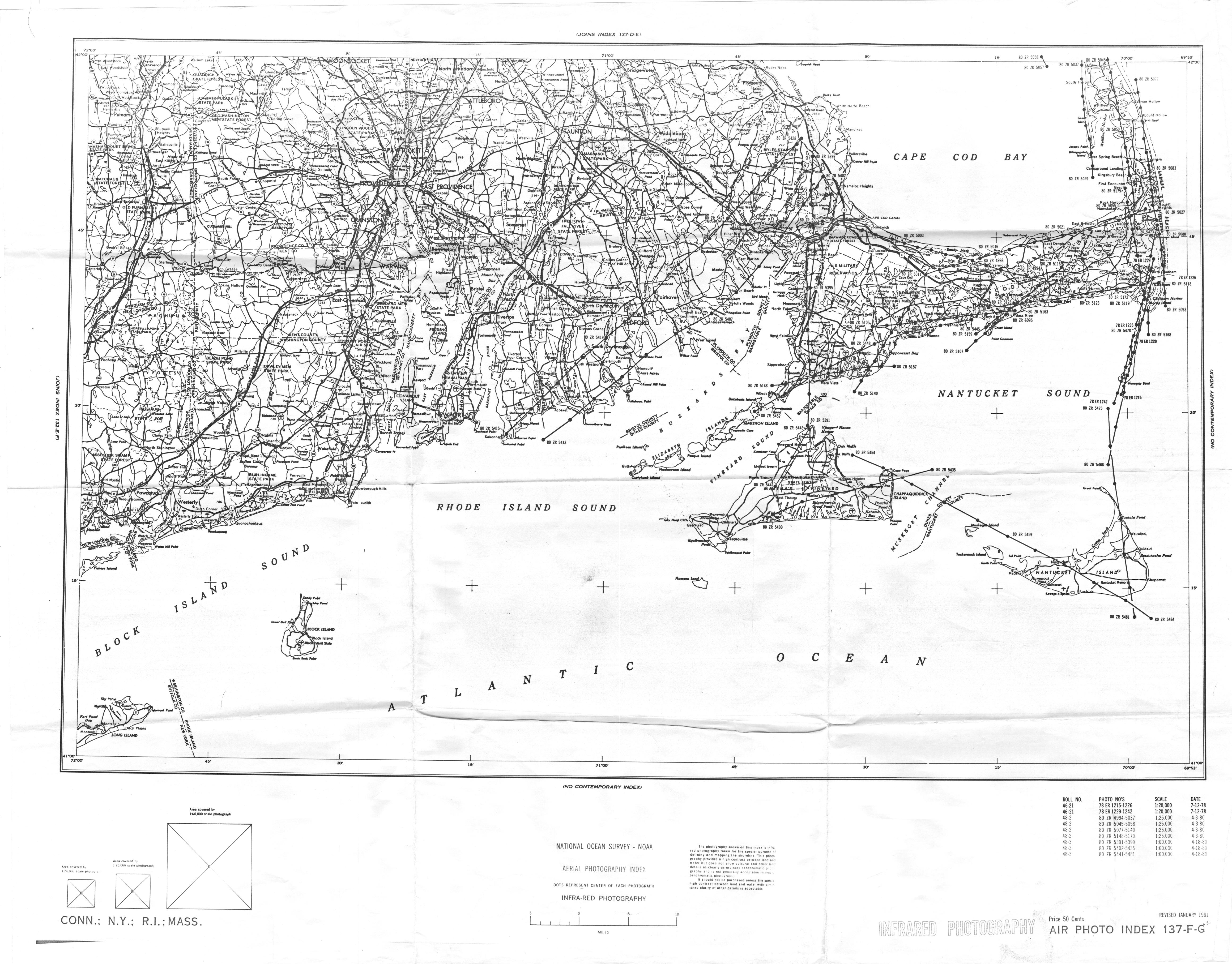
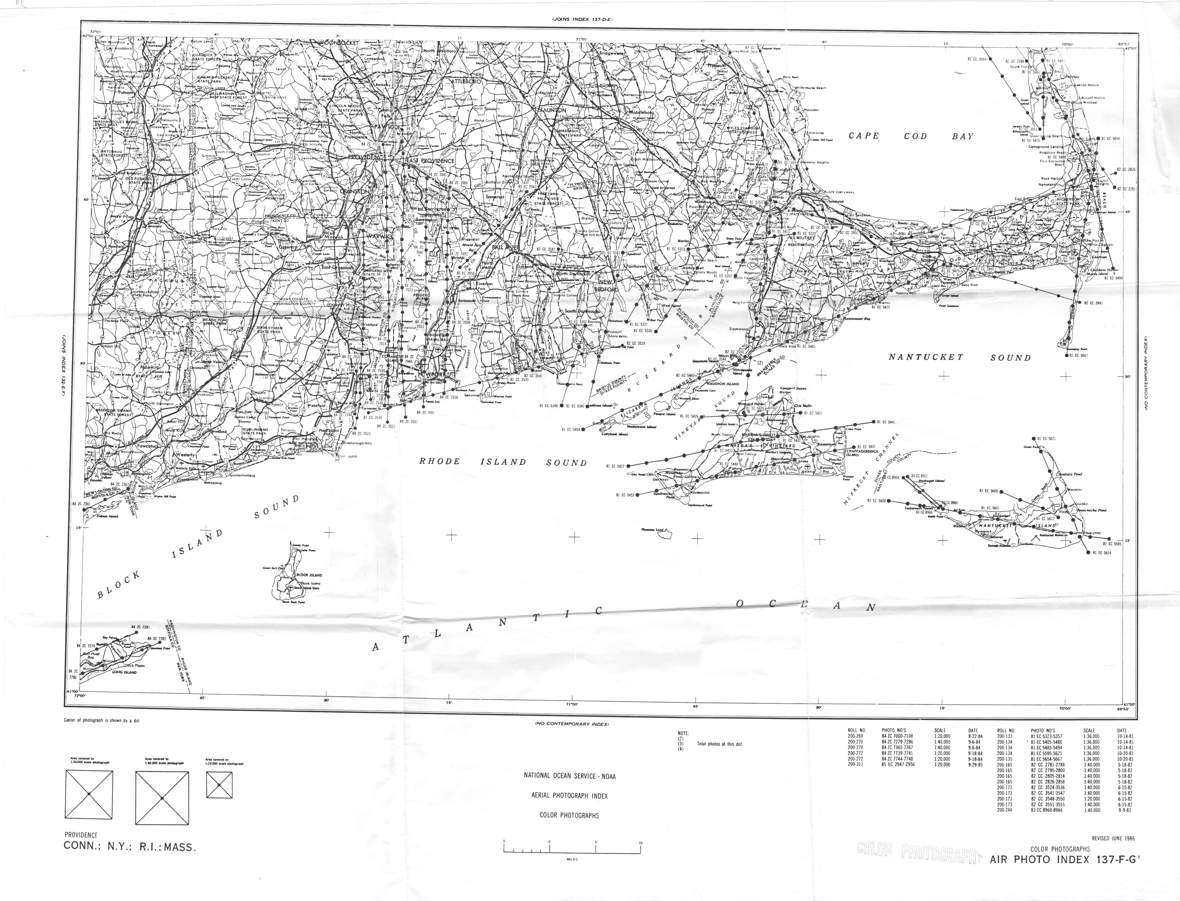
The table below summarizes historical aerial photographs used by Costa in his 1980 study of historical eelgrass distribution in Buzzards Bay and southeastern Massachusetts, plus some other later sources used on this website. Although numerous dates are shown, many of the surveys are for small stretches of coast, or just for a particular town. Most of the pre-1990 photographs exist only as film negatives or contact prints at the agencies, but digital scans can be ordered at $25 to $45 each. To order any of the photographs in the map indexes on this page (except National Archives imagery), send an email to NOAA following the guidance at this link. The squares at the bottom of the map index show the approximate area covered by each photograph. For the National Archives imagery, go to this link.
To download recent and historical aerials, refer to the links on our Using Historical Aerial Photographs page. One of the most of these links is the USGS Earth Explorer page.
.
| Survey_Date | Type | Scale | PhotoIndex | Source | Comments |
| 1934-11-15 | Map | 1;25,000 | Nautical Survey T-Sheet | 1936 map (NOAA T-sheet) drawn from 11/15/1934 aerial photograph | |
| 1937? | B&W Film | 1:10,200 | National Archives, M-568, Can G-12975, US Air Force | Covers only New Bedford and Dartmouth, survey date obscured on index | |
| 1938-11-21 | B&W Film | 1:30,000 | National Archives, Record Group 57 | Cape Cod on this date. RG57 includes Waquoit (Eelgrass clear on GS-F-5-104). Photographs taken near low tide. | |
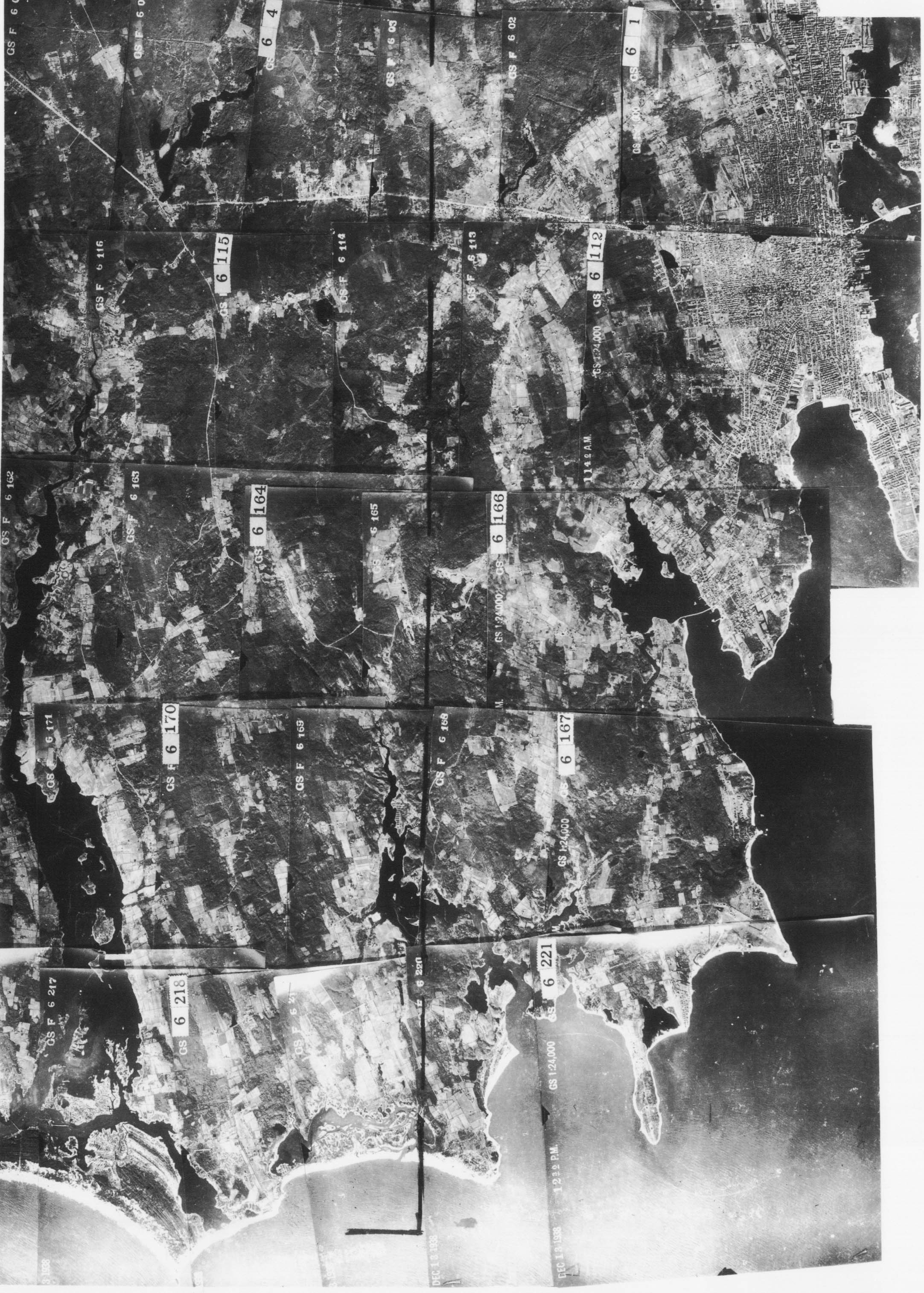
| 1938-12-13 | B&W Film | 1:30,000 | Westport-Dartmouth-12-13-1938 | National Archives, Record Group 58, NAR downloads and from contact print Costa archive. | Survey includes west coast of Buzzards Bay. Water mostly turbid on this date. Photographs taken approximately 3 months after Hurricane of 1938, during a spring high tide, with poor water transparency. Preceding week temperatures above freezing with 4 inches of rain (New Bedford weather data). Example: GS-F-6-166 (Apponagansett) |
| 1941-winter | B&W Film | 1:30,000 | National Archives, Record Group 373, Can 6A-835 | Ice in upper Apponagansett, but some eelgrass visible (E152) | |
| 1942–06?-?? | B&W Film | 1:30,000 | National Archives, Record Group 373, Can H-14830 | NB-9-464 good image of Westport. Survey time: early afternoon photo, shadow (~+15 degrees of N) | |
| 1943-06-24 | B&W Film | 1:30,000 | National Archives, Record Group 373, Can 4A-896 | Good imagery overall with relatively low altitude moderate wind waves in SW facing areas. Example: MB-7-122 (Megansett-Wings Cove) | |
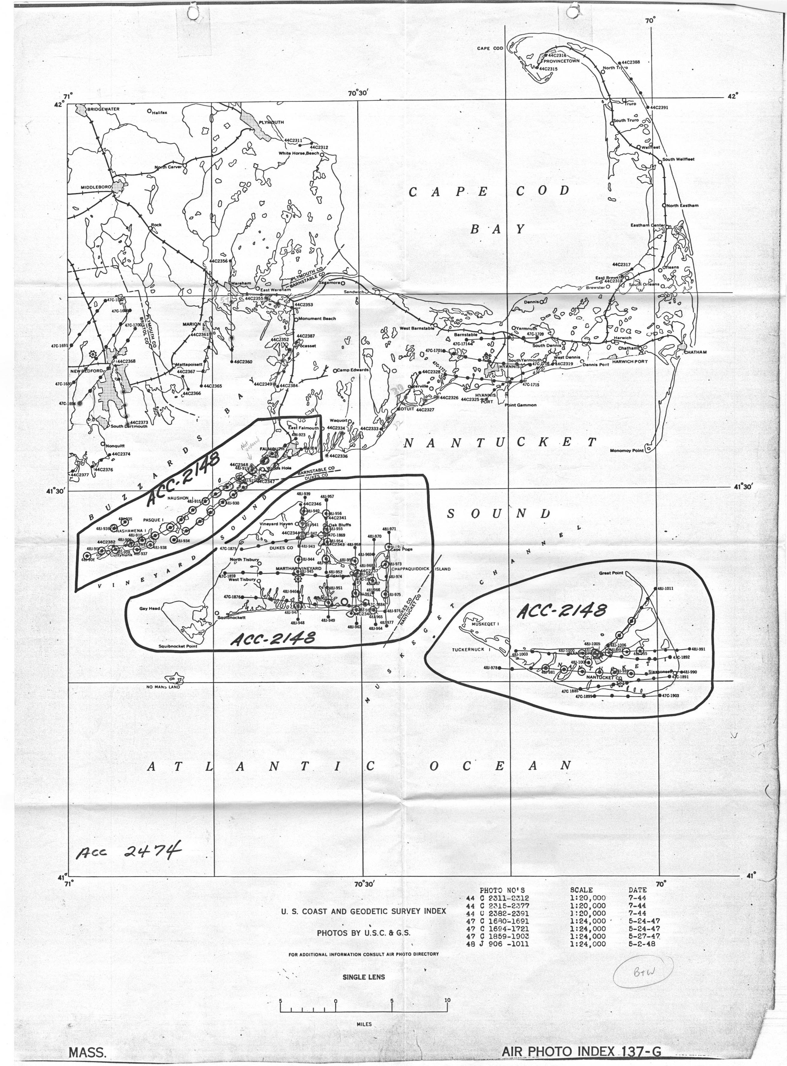
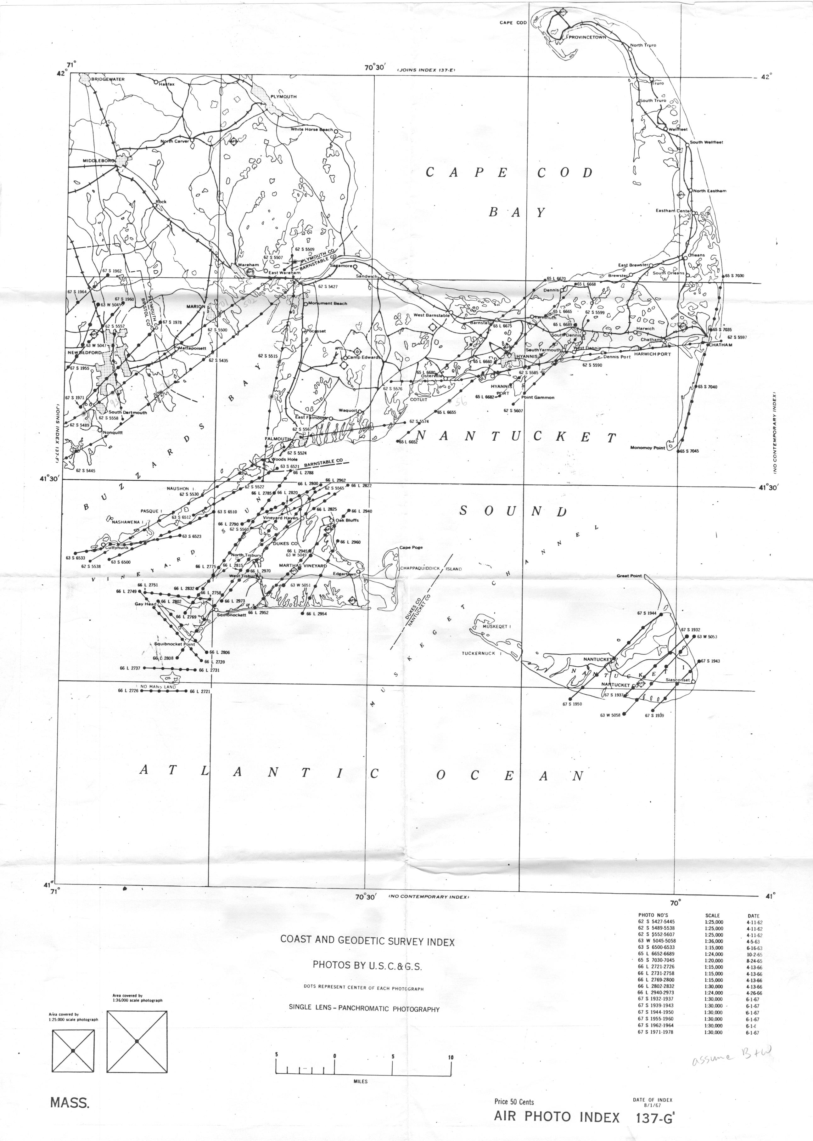
| 1944-07-18 | B&W Film | 1:20,000 | 137-G-1948 | C&GS (USGS) | Generally excellent for eelgrass analysis, good water transparency, low glare in protected areas. |
| 1947-05-24 | B&W Film | 1:24,000 | 137-G-1948 | C&GS (USGS) | time: 13:00 EST at Apponagansett Bay |
| 1947-05-27 | B&W Film | 1:24,000 | 137-G-1948 | C&GS (USGS) | |
| 1948-05-02 | B&W Film | 1:24,000 | 137-G-1948 | C&GS (USGS) | Excellent Imagery |
| 1951-09-28 | B&W Film | 1:5,000 | Mass DPW?, survey firm unknown | Includes New Bedford area, Low altitude and exceptional for document eelgrass beds, especially in areas already recovered from the Wasting Disease | |
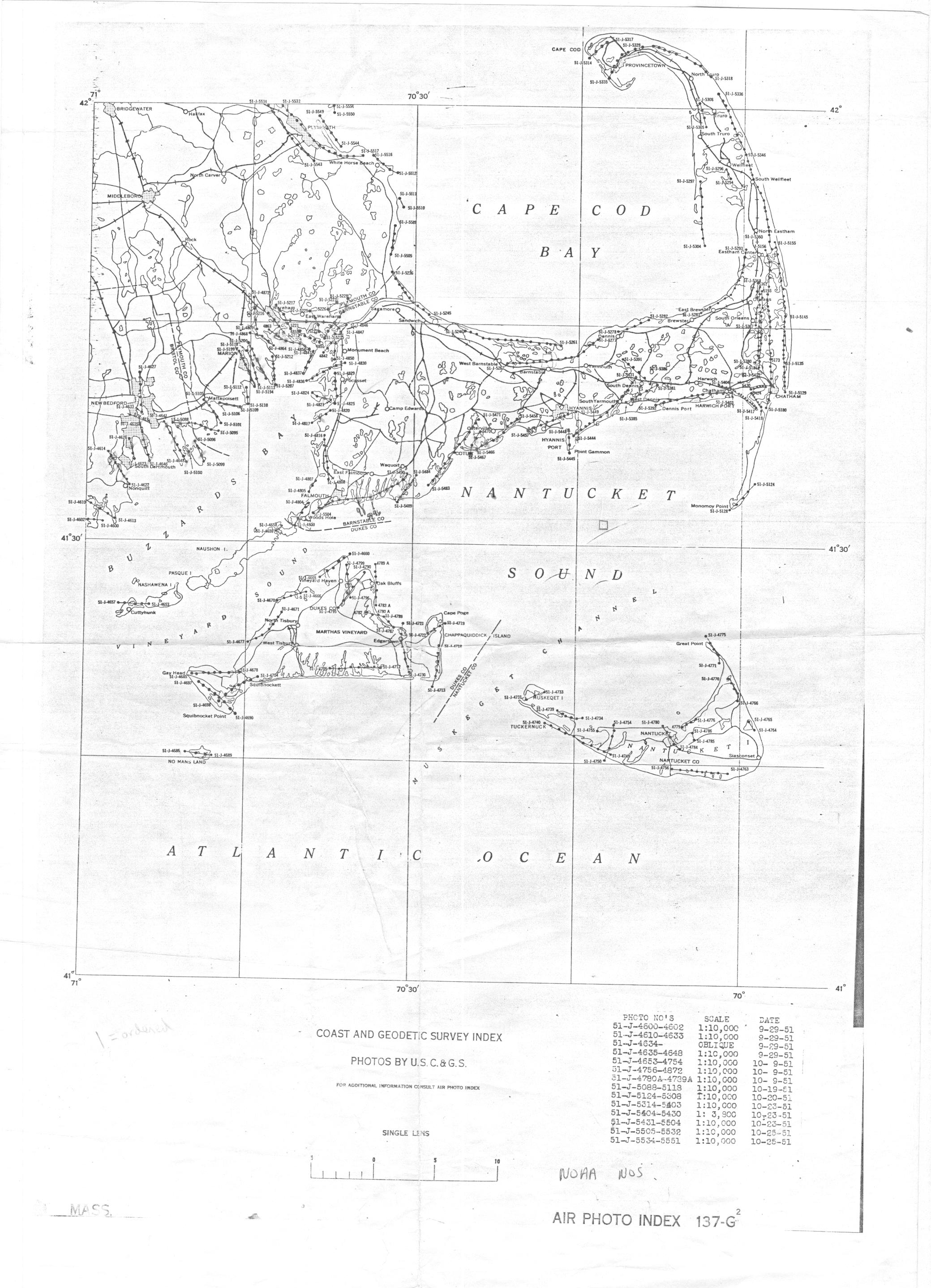
| 1951-10-09 | B&W Film | 1:10,000 | 137-G2-1951 | Low altitude and exceptional for document eelgrass beds, especially in areas already recovered from the Wasting Disease | |
| 1951-10-19 | B&W Film | 1:10,000 | 137-G2-1951 | Low altitude and exceptional for document eelgrass beds, especially in areas already recovered from the Wasting Disease | |
| 1951-10-20 | B&W Film | 1:10,000 | 137-G2-1951 | Low altitude and exceptional for document eelgrass beds, especially in areas already recovered from the Wasting Disease | |
| 1951-10-22 | B&W Film | 1:20,000 | Umass? PMA | DPL-2K-12 is off West Bay, exceptional transparency | |
| 1951-10-23 | B&W Film | 1:4-10,000 | 137-G2-1951 | Low altitude and exceptional for document eelgrass beds, especially in areas already recovered from the Wasting Disease | |
| 1951-10-25 | B&W Film | 1:10,000 | 137-G2-1951 | Low altitude and exceptional for document eelgrass beds, especially in areas already recovered from the Wasting Disease | |
| 1951-09-29 | B&W Film | 1:10,000 | 137-G2-1951 | ||
| 1952-07-26 | 1:20,000 | UMass? DPT, Plymouth Cons. Dist. | |||
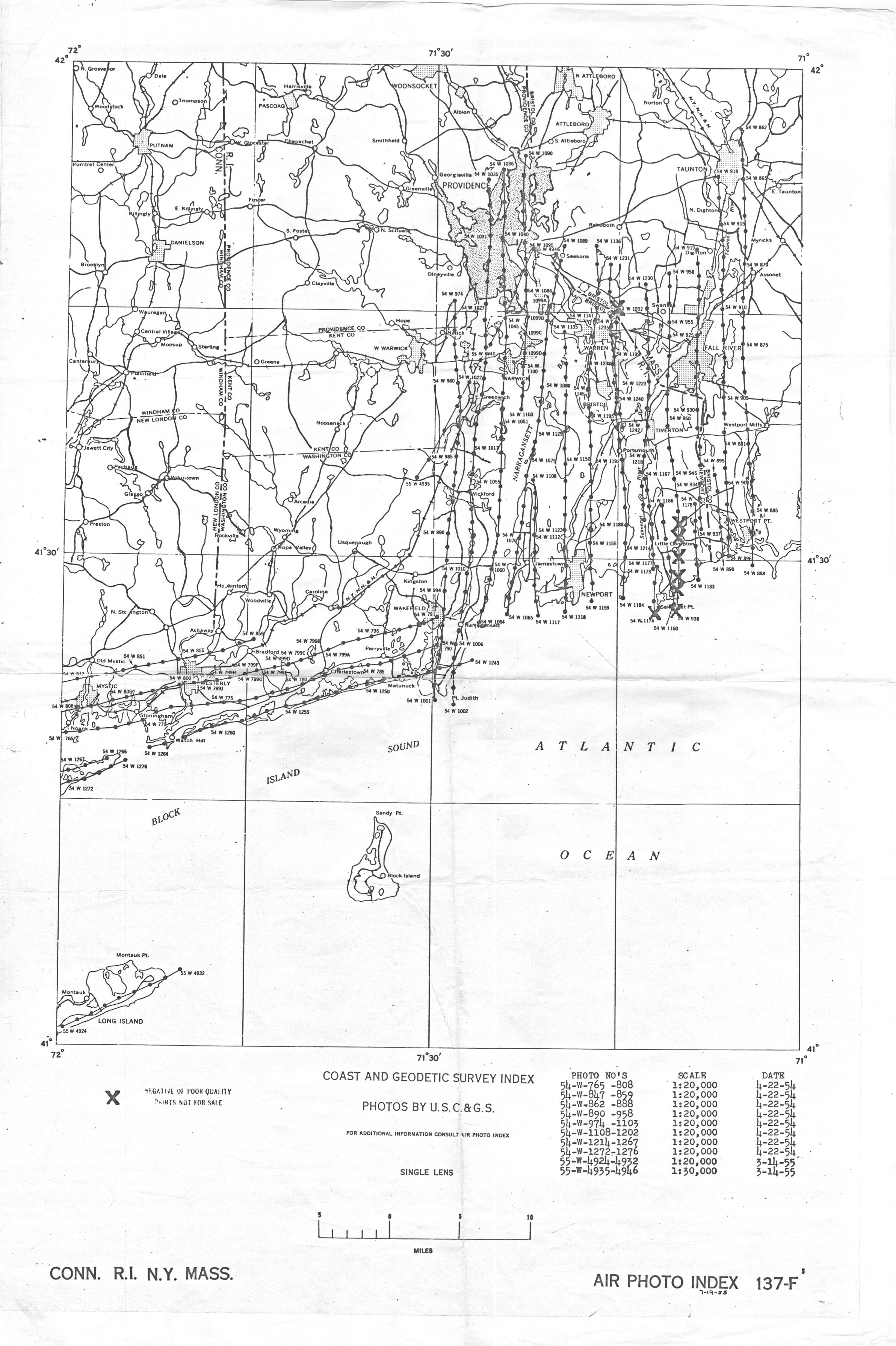
| 1954-04-22 | B&W Film | 1:20,000 | 137-F5-1955, also in 137-F3? | C&GS (USGS) | Excellent imagery for Westport Harbor. |
| 1955-03-14 | B&W Film | 1:20,000 to 1:30,000 | 137-F5-1955 | ||
| 1955-11-15 | B&W Film | 1:40,000 | Though high altitude, good transparency and quality | ||
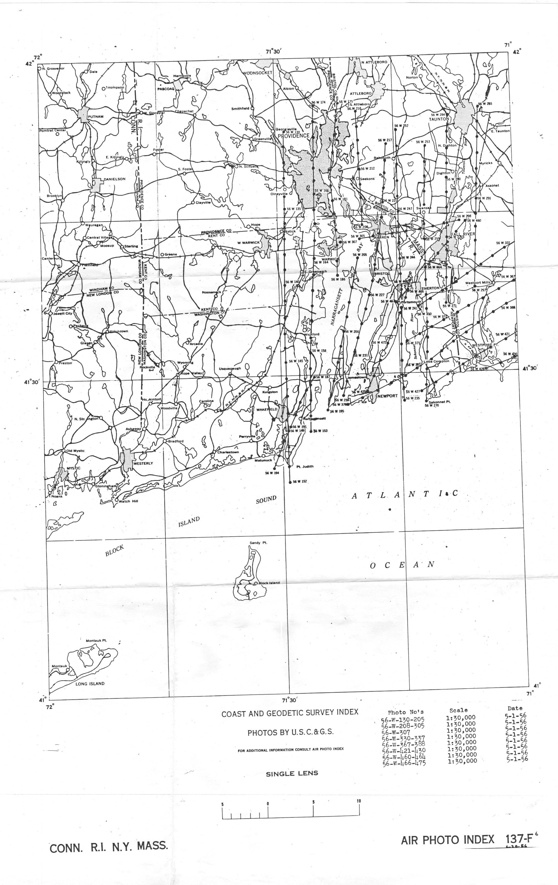
| 1956-05-01 | B&W Film | 1:30,000 | 137F6_1956 | C&GS (USGS) | Good conditions overall except development contrast too high so that eelgrass cannot be seen except on sandy or bottoms. Image enhancement required, however water transparency excellent. |
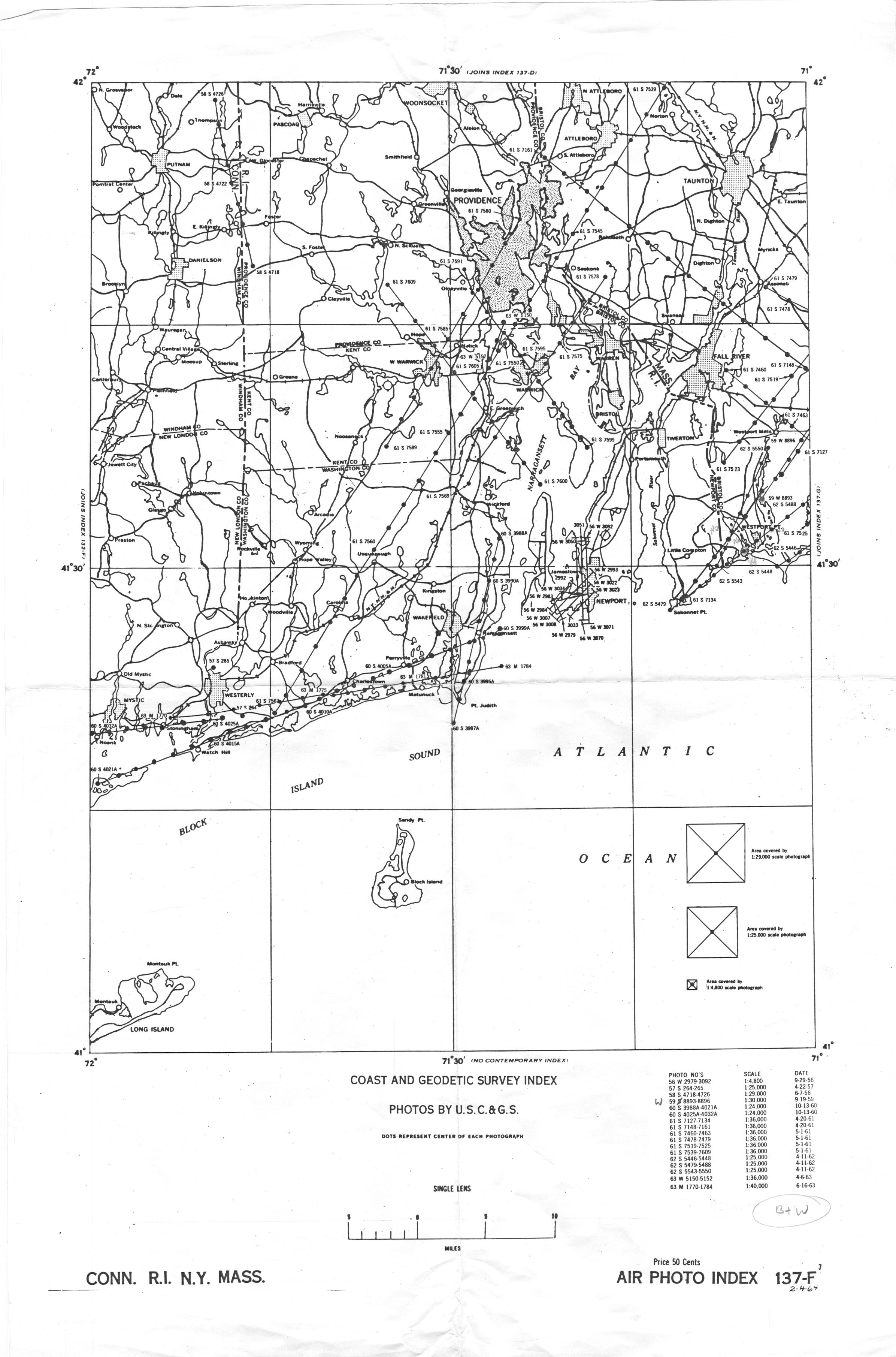
| 1956-09-29 | B&W Film | 1:4,800 | 137-F7-1964 | C&GS (USGS) | |
| 1958-04-30 | B&W Film | 1:10,000 | MA DPW, survey by Fairchild Aerial Surveys, Long Island City | ||
| 1957-04-22 | B&W Film | 1:25,000 | 137-F7-1964 | C&GS (USGS) | |
| 1958-06-07 | B&W Film | 1:29,000 | 137-F7-1964 | C&GS (USGS) | |
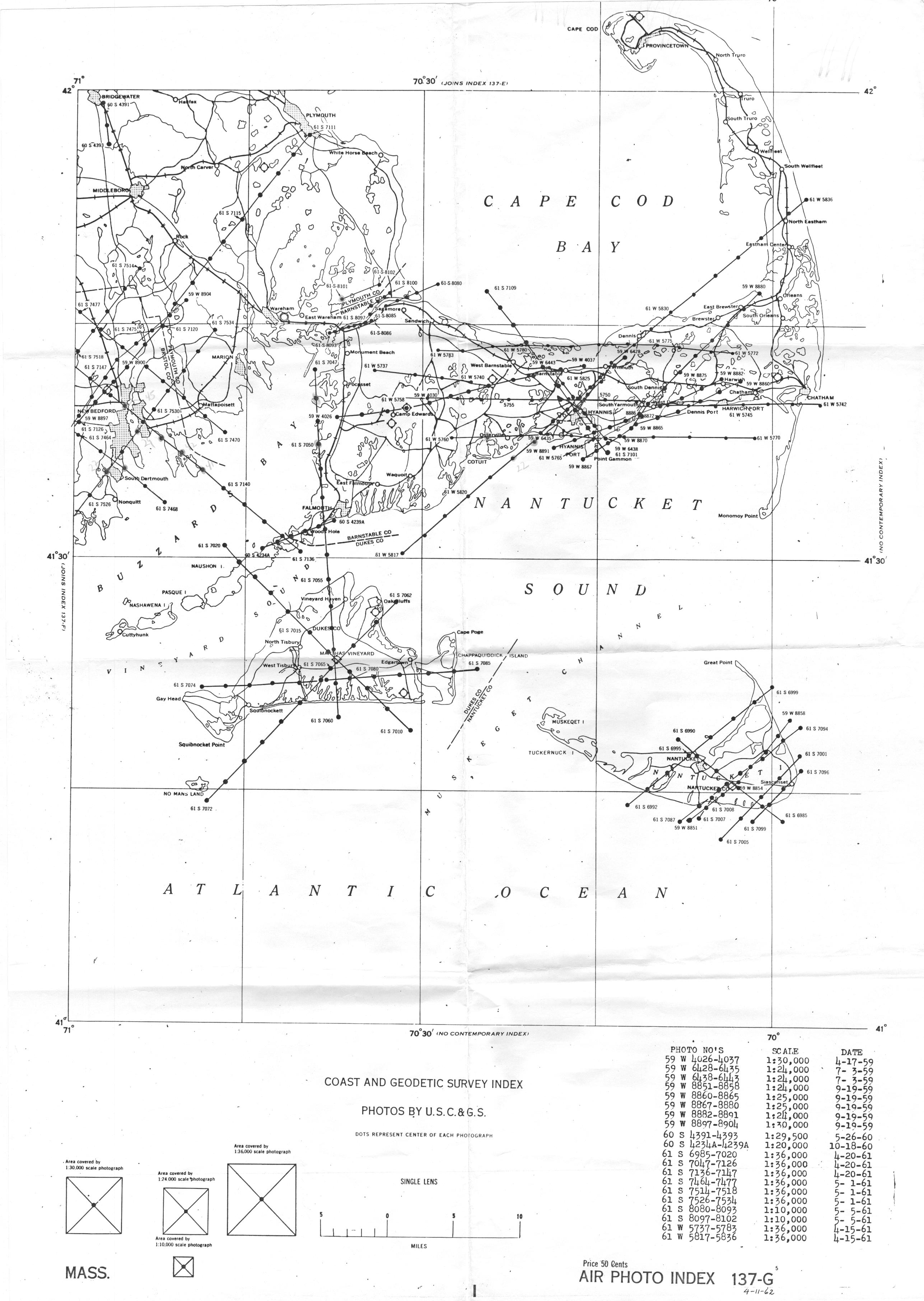
| 1959-04-17 | B&W Film | 1:30,000 | 137-G5-1962 | C&GS (USGS) | |
| 1959-07-03 | B&W Film | 1:24,000 | 137-G5-1962 | C&GS (USGS) | |
| 1959-09-19 | B&W Film | 1:24,000 to 1:30,000 | 137-F7-1964 137-G5-1962 |
C&GS (USGS) | good example from Westport |
| 1960-05-10 | B&W Film | USAF, AF-59-338 | Very High altitude high contrast survey of limited utility for mapping eelgrass cover, probably worth ordering hires digital scans of imagery if available. Example of Falmouth. | ||
| 1960-05-26 | B&W Film | 1:29,500 | 137-G5-1962 | C&GS (USGS) | |
| 1960-10-13 | B&W Film | 1:24,000 | 137-F7-1964 | C&GS (USGS) | |
| 1960-10-18 | B&W Film | 1:20,000 | 137-G5-1962 | C&GS (USGS) | |
| 1961-03-31 | B&W Film | 1:30,000 | USDA? GS-VAEL | Good example of Nasketucket Bay (1-162) | |
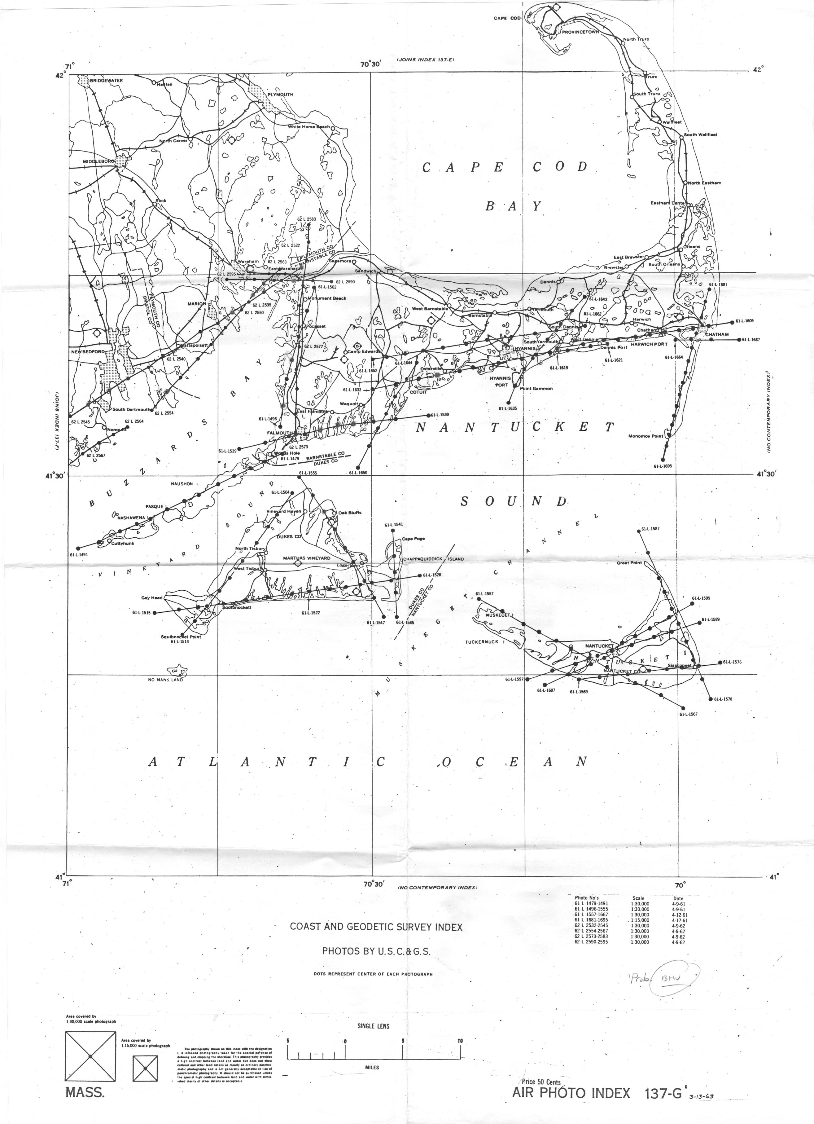
| 1961-04-09 | B&W Film | 1:30,000 | 137-G6-1963 | C&GS (USGS) | |
| 1961-04-12 | B&W Film | 1:30,000 | 137-G6-1963 | C&GS (USGS) | |
| 1961-04-15 | B&W Film | 1:36,000 | 137-G5-1962 | C&GS (USGS) | Good visibility in Osterville (W5822) |
| 1961-04-17 | B&W Film | 1:15,000 | 137-G6-1963 | C&GS (USGS) | |
| 1961-04-20 | B&W Film | 1:36,000 | 137-F7-1964 137-G5-1962 |
C&GS (USGS) | Good visibility in Megansett (S7048) |
| 1961-05-01 | B&W Film | 1:36,000 | 137-F7-1964 137-G5-1962 |
C&GS (USGS) | Fair water transparency |
| 1961-05-05 | B&W Film | 1:10,000 | 137-G5-1962 | C&GS (USGS) | |
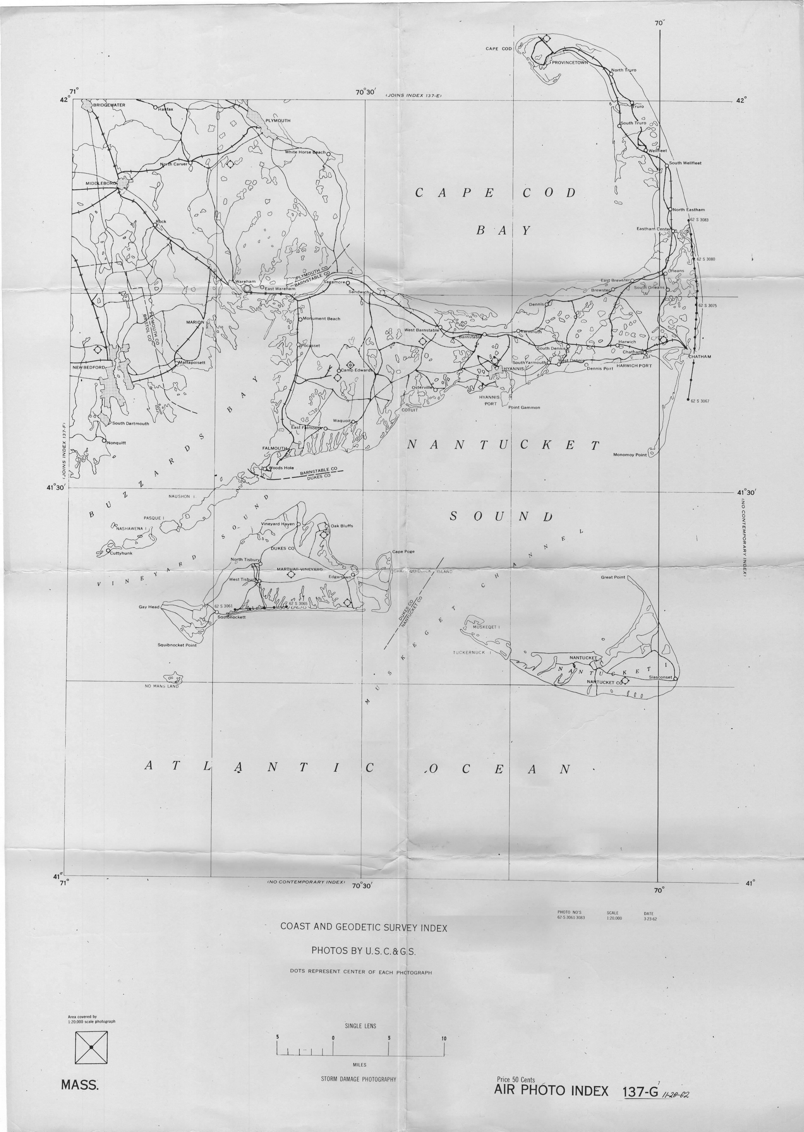
| 1962-03-23 | Color Film | 1:20,000 | 137-G7-1962 | C&GS (USGS) | |
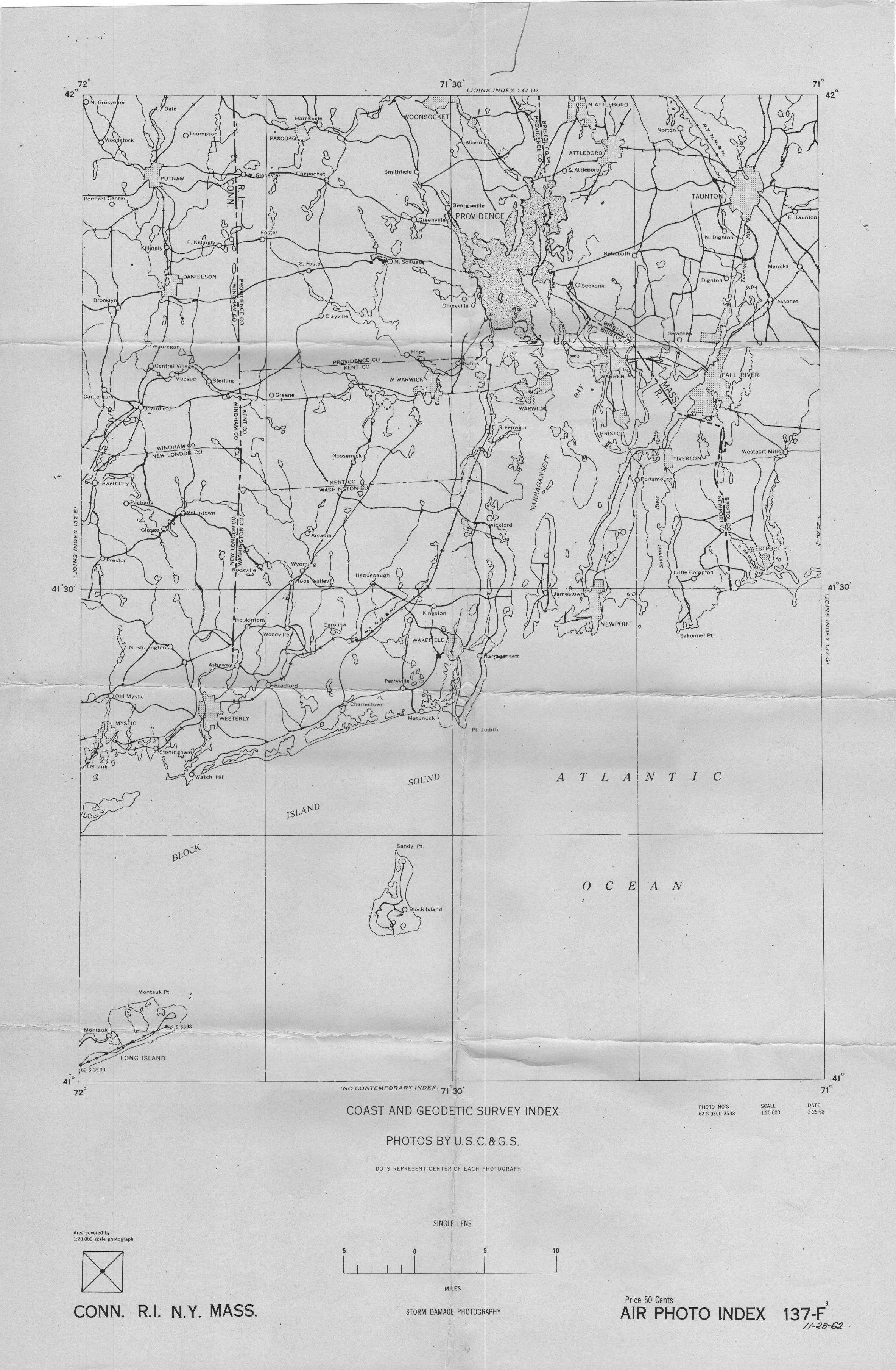
| 1962-03-25 | Color Film | 1:20,000 | 137-F9-1962 | C&GS (USGS) | |
| 1962-04-09 | B&W Film | Altitude too high and development contrast too high so that eelgrass cannot be seen except on sandy bottoms. Useful only in a few areas.. | |||
| 1962-04-09 | Color Film | 1:30,000 | 137-F8-1966 137-G6-1963 |
C&GS (USGS) | |
| 1962-04-10 | Color Film | 1:15,000 to 1:20,000 | 137-F2-1966 | C&GS (USGS) | Very good to excellent for eelgrass work. |
| 1962-04-11 | B&W Film | 1:25,000 | 137-F7-1964 137-G8-1967 |
C&GS (USGS) | Very good to excellent for eelgrass work. |
| 1963-04-05 | B&W Film | 1;36,000 | 137-G8-1967 | C&GS (USGS) | |
| 1963-04-06 | B&W Film | 1:36,000 | 137-F7-1964 | C&GS (USGS) | |
| 1963-06-16 | B&W Film | 1:40,000 | 137-F7-1964 | C&GS (USGS) | |
| 1963-06-16 | Color Film | 1:20,000 | 137-F2-1966 | C&GS (USGS) | |
| 1963-06-16 | B&W Film | 1:15,000 | 137-G8-1967 | C&GS (USGS) | |
| 1964-04-22 | B&W Film | 1:20,000 | Good example from Westport | ||
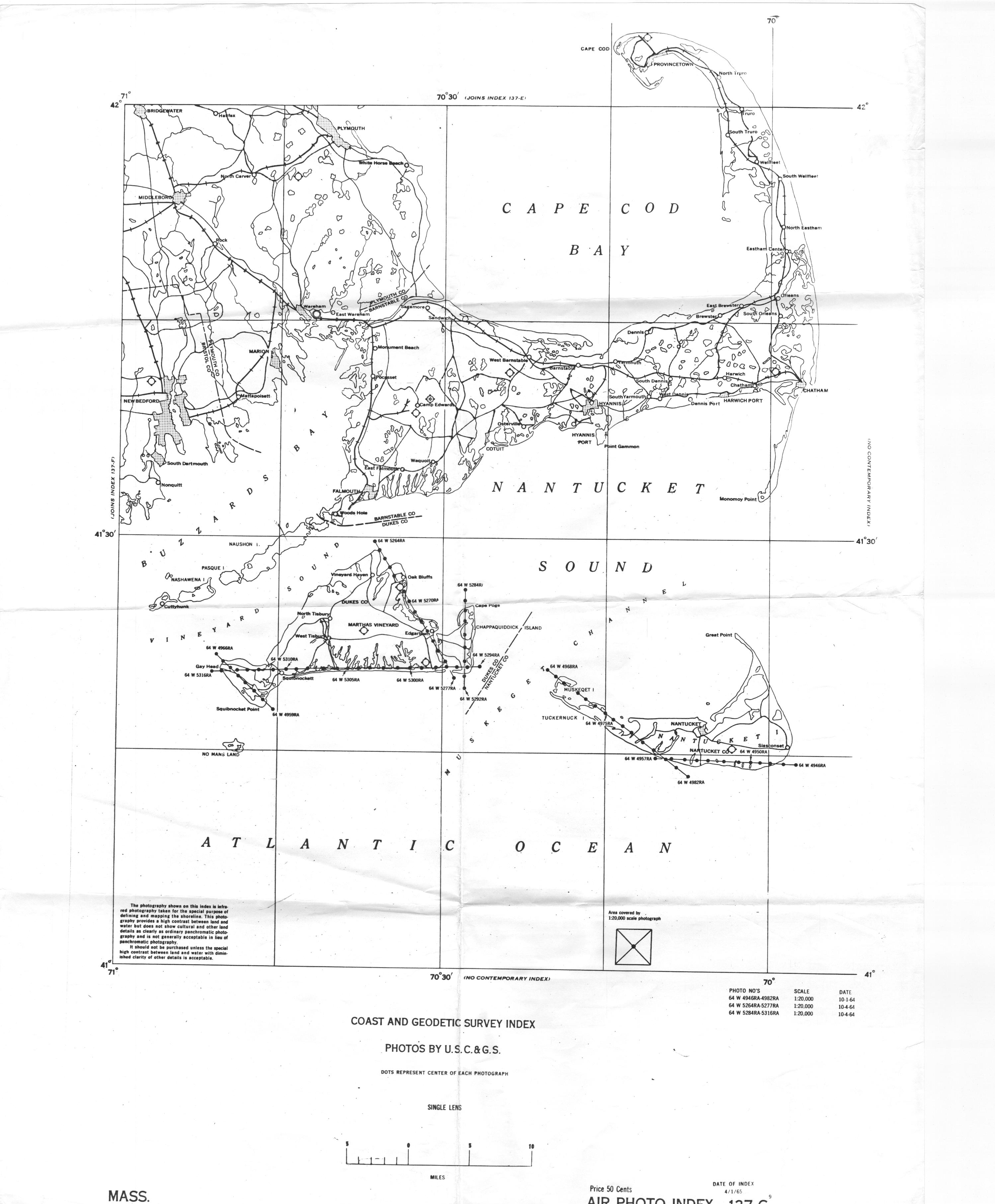
| 1964-10-01 | B&W Film | 1:20,000 | 137-G9-1965 | C&GS (USGS) | |
| 1964-10-04 | B&W Film | 1:20,000 | 137-G9-1965 | C&GS (USGS) | |
| 1964-10-31 | Color Film | 1:20,000 | 137-F10-1973 | NOAA NOS Survey | |
| 1965-08-24 | B&W Film | 1:20,000 | 137-G8-1967 | NOAA NOS Survey | |
| 1965-09-25 | Color Film | 1:40,001 | 137-F2-1966 | NOAA NOS Survey | |
| 1965-09-27 | Color Film | 1:20,000 | 137-F2-1966 | NOAA NOS Survey | |
| 1965-10-02 | Color Film | 1:30,000 to 1:40,000 | 137-F8-1966 137-F2-1966 |
C&GS (USGS) | Very good for eelgrass interpretation |
| 1965-10-02 | B&W Film | 1:24,000 | 137-G8-1967 | C&GS (USGS) | |
| 1965-10-02 | B&W Film | 1:40,000 | 137-F8-1966 | C&GS (USGS) | |
| 1966-02-22 | B&W Film | 1:40:000 | USDA? GS-VBKD | February survey with ice cover in protected areas, but eelgrass clearly observable in some embayments. Average water transparency. | |
| 1966-04-13 | B&W Film | 1:15,000 to 1:30,000 | 137-G8-1967 | C&GS (USGS) | |
| 1966-04-26 | B&W Film | 1:24,000 | 137-G8-1967 | C&GS (USGS) | |
| 1966-09-17 | Color Film | 1:20,000 | 137-G4-1974 | C&GS (USGS) | Good to excellent for eelgrass survey for eelgrass, excellent conditions in protected areas |
| 1967-06-01 | Color Film | 1:30,000 | 137-F10-1973 137-G8-1967 |
NOAA NOS Survey | |
| 1967-06-03 | Color Film | 1:30,000 | 137-F10-1973 | NOAA NOS Survey | |
| 1968-07-21 | Color Film | 1:30,000 | 137-G4-1974 | NOAA NOS Survey | Excellent survey for eelgrass interpretation. |
| 1969-04-25 | Color Film | 1:30,000 | 137-F10-1973 | NOAA NOS Survey | |
| 1969-11-13 | B&W Film | 1:24,000 | USDA? GS-VCIQ | Good example of Vineyard Haven | |
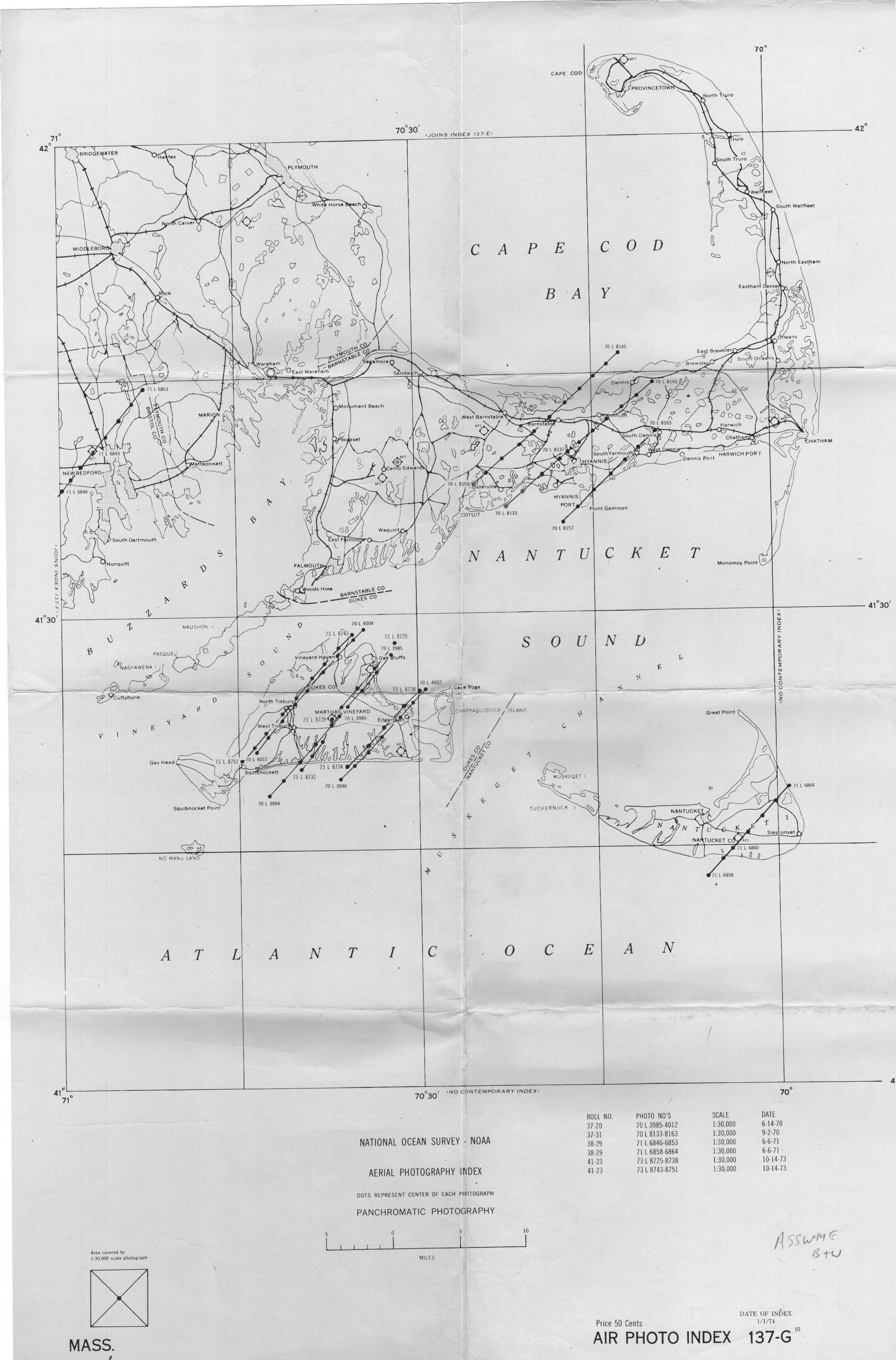
| 1970-06-14 | B&W Film | 1:30,000 | 137-G10-1974 137-G4-1974 |
NOAA NOS Survey | |
| 1970-09-02 | B&W Film | 1:30,000 | 137-G10-1974 | NOAA NOS Survey | Good to excellent quality and transparency |
| 1970-09-02 | Color Film | 1:20,000 | 137-G4-1974 | NOAA NOS Survey | |
| 1970-09-12 | Color Film | 1:20,000 | 137-G4-1974 | NOAA NOS Survey | |
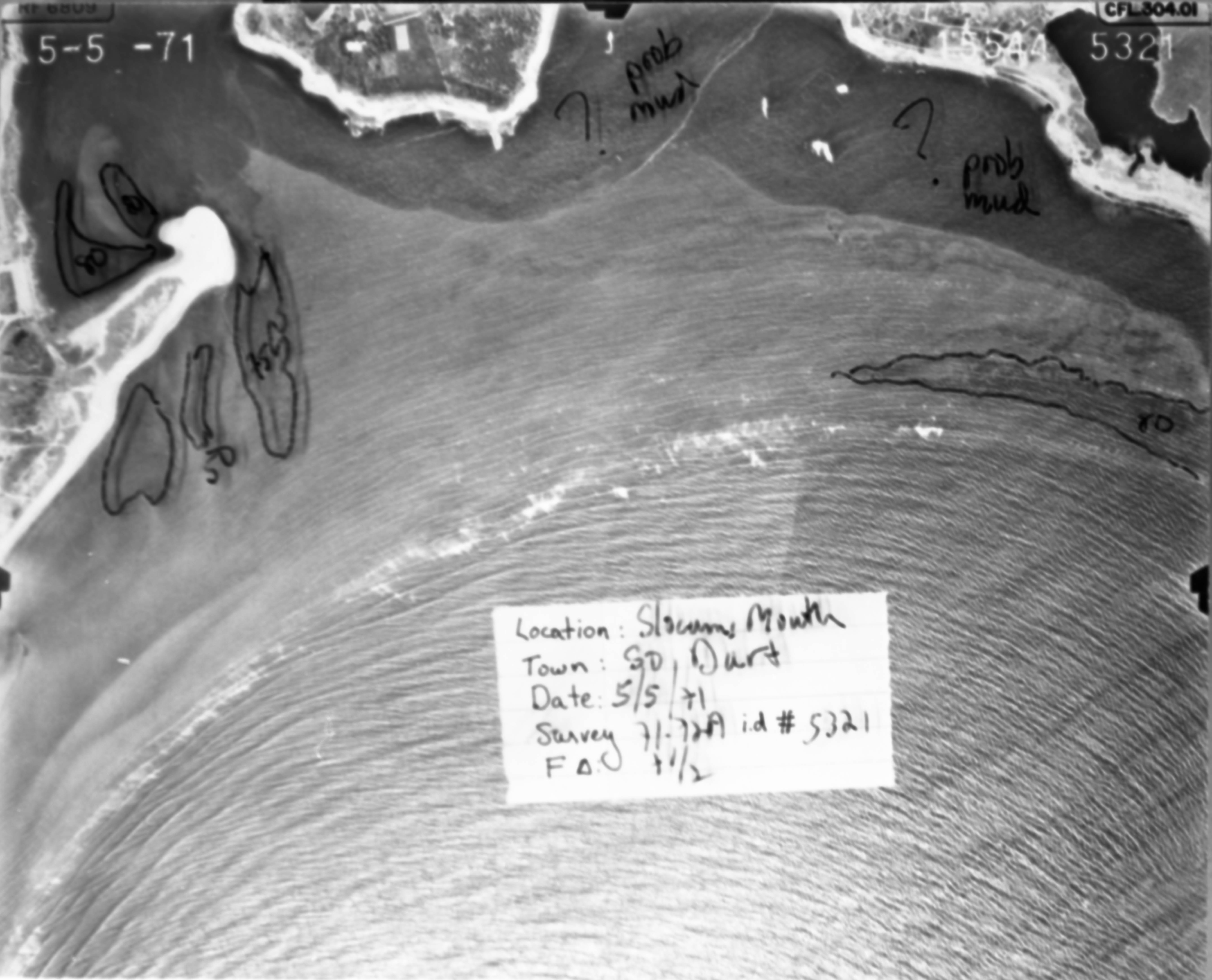
| 1971-05-05 | B&W Film | 1:5,000? | MA-DPW-7172A | MA DPW | Probably various dates. B&W slides of some annotated prints made by Costa. sample: 15544-5321 |
| 1971-05-14 | B&W Film | 1:24,000 | USDA? GS-VCRQ | Fair to good for eelgrass interpretation | |
| 1971-06-06 | Color Film | 1:30,000 | 137-F10-1973 | NOAA NOS Survey | |
| 1971-06-06 | B&W Film | 1:30,000 | 137-G10-1974 | NOAA NOS Survey | |
| 1971-06-06 | Color Film | 1:20,000 | |||
| 1971-08-05 | B&W Film | 1:20,000 | UMass Plymouth Conservation District | Bird Island at DPT-3MM-33 | |
| 1971-10-08 | Color Film | 1:20,000 | 137-G4-1974 | NOAA NOS Survey | Good to excellent quality and transparency |
| 1972-08-21 | Color Film | 1:30,000 | 137-F10-1973 | NOAA NOS Survey | |
| 1973-10-12 | Color Film | 1:20,000 | 137-G4-1974 | NOAA NOS Survey | |
| 1973-10-14 | B&W Film | 1:30,000 | 137-G10-1974 | NOAA NOS Survey | |
| 1974-02-27 | B&W | USGS GS | |||
| 1974-04-18 | Color Film | 1:30,000 | NOAA NOS Survey | Good to excellent for eelgrass interpretation | |
| 1974-04-20 | Color Film | 1:30,000 | Good to excellent for eelgrass interpretation | ||
| 1974-09-16 | Color Film | 1:30,000 | 137-F-G-1976 | NOAA NOS Survey | |
| 1974-10-11 | Color Film | 1:30,000 | 137-F-G-1976 | NOAA NOS Survey | |
| 1975-04-14 | B&W Film | 1:10,000 | James W. Sewall Co. | Very useful low altitude Falmouth, Ma survey with good tidal conditions and water transparency. Example K895-13-17 (Snug Harbor, West Falmouth) | |
| 1975-06-21 | Color Film | 1:30,000 | 137-F-G-1976 | NOAA NOS Survey | |
| 1977-08-25 | Color Film | 1:36,000 | 137-F-G3-1978 | NOAA NOS Survey | |
| 1978-05-08 | B&W Film | Lockwood-8May78 | Lockwood Support Serv | Bourne, Falmouth, Good to excellent for eelgrass analysis | |
| 1978-06-15 | B&W Film | 1:36,000 | 137-F-G4-1980 | NOAA NOS Survey | |
| 1978-07-06 | B&W Film | 1:30,000 | 137-F-G4-1980 | NOAA NOS Survey | |
| 1978-07-12 | B&W Film | 1:30,000 | 137-F-G4-1980 137-F-G5-1981 |
NOAA NOS Survey | |
| 1978-07-12 | Color film | 1:20,000 | 137-F-G5-1981 | NOAA NOS Survey | |
| 1979-10-30 | B&W Film | 1:60,000 | 137-F-G4-1980 | NOAA NOS Survey | High altitude, but excellent quality and transparency, worth ordering digital scans at high resolution |
| 1979-10-31 | B&W Film | 1:60,000 | 137-F-G4-1980 | NOAA NOS Survey | |
| 1979-11-05 | B&W Film | 1:60,000 | 137-F-G4-1980 | NOAA NOS Survey | High altitude, good transparency in protected areas |
| 1980-04-03 | Color film | 1:25,000 | 137-F-G5-1981 | NOAA NOS Survey | |
| 1980-04-18 | Color film | 1:60,000 | 137-F-G5-1981 | NOAA NOS Survey | |
| 1980-04-18 | Infra-Red | 1:60k | 137-F-G5-1981 | NOS-NOAA | |
| 1980-04–07 | B&W | USGS-VESC | |||
| 1981-10-14 | Color Film | 1:36,000 | 137-F-G3-1986 | NOAA NOS Survey | Exceptional water transparency, low sun angle, low tides, and early fall high eelgrass biomass make this the best baywide aerial survey ever taken that can be used for mapping eelgrass cover |
| 1981-10-20 | Color Film | 1:36,000 | 137-F-G3-1986 | NOAA NOS Survey | |
| 1982-05-18 | Color Film | 1:40,000 | 137-F-G3-1986 | NOAA NOS Survey | |
| 1982-06-15 | Color Film | 1:40,000 | 137-F-G3-1986 | NOAA NOS Survey | |
| 1983-09-09 | Color Film | 1:40,000 | 137-F-G3-1986 | NOAA NOS Survey | |
| 1984-08-22 | Color Film | 1:20,000 | 137-F-G3-1986 | NOAA NOS Survey | |
| 1984-09-06 | Color Film | 1:40,000 | 137-F-G3-1986 | NOAA NOS Survey | |
| 1984-09-18 | Color Film | 1:20,000 | 137-F-G3-1986 | NOAA NOS Survey | |
| 1985-09-29 | Color Film | 1:20,000 | 137-F-G3-1986 | NOAA NOS Survey | |
| 1990-04-09 | Color IR Film | UMADEP_4_9_90_index | DEP UMASS WCP | Includes Buzzards Bay and Elizabeth Islands. DEP/UMA Iris used for Wetlands Conservancy Program. Too early in season for general use, good for deep beds in sandy areas, exceptional intertidal algal covered rock coverage for Elizabeth Islands and elsewhere because of tide elevation. Good example: Strawberry Point, Mattapoisett’s (1-109) | |
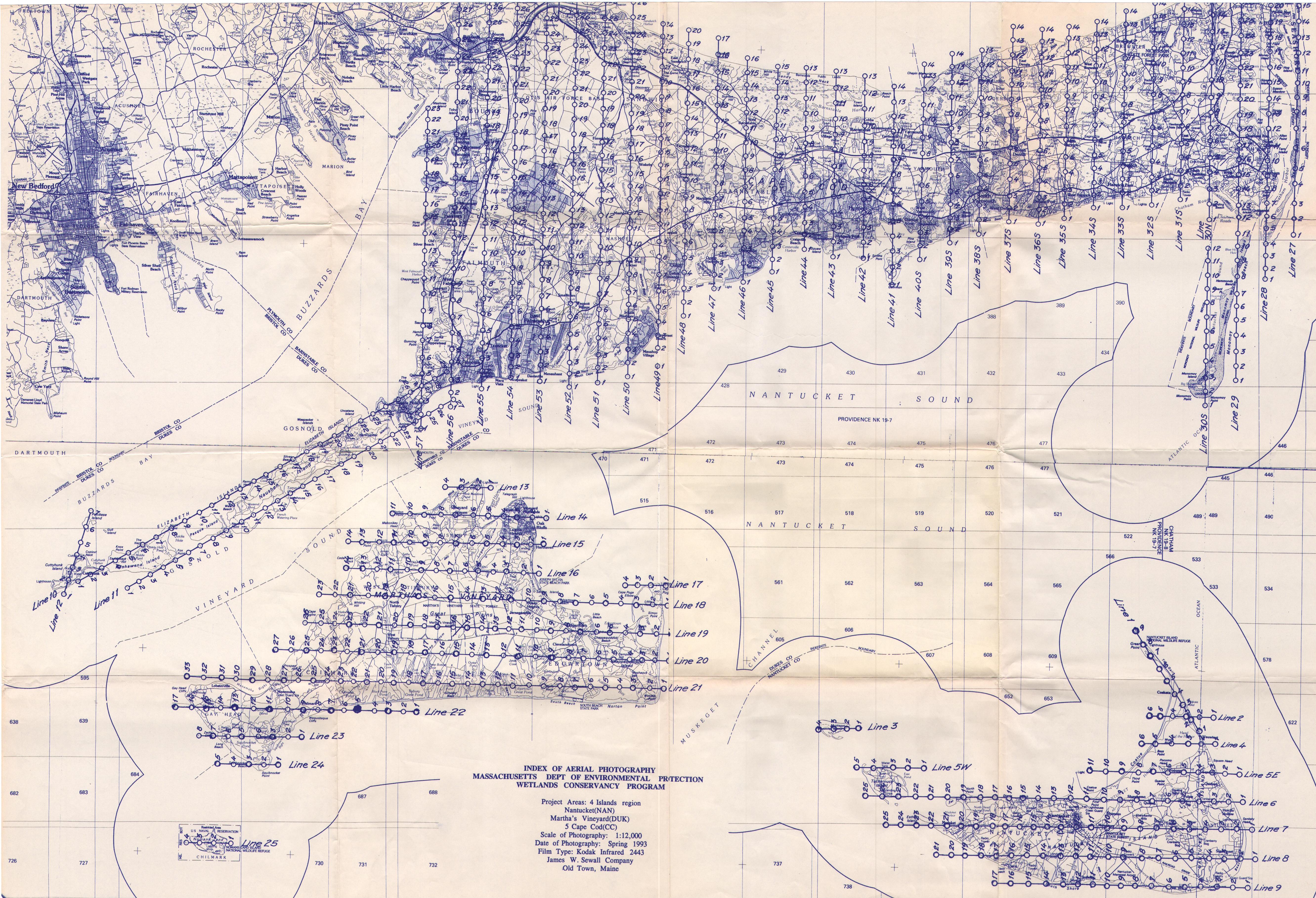
| 1993-03-31 | Color IR Film | UMADEP_Spring_93 | DEP Wetland Conservancy Program James Sewall |
Includes Elizabeth Islands. DEP/UMass IRs used for Wetlands Conservancy Program. Too early in season for general use, good for deep beds in sandy areas, exceptional intertidal algal covered rock coverage for Elizabeth Islands and elsewhere because of tide elevation | |
| 1993-04-05 | Color IR Film | UMADEP_Spring_93 | James Sewall Old Town DEP/UMA Wetland Conservancy Program |
Includes Buzzards Bay. DEP/UMass IRs used for Wetlands Conservancy Program. Too early in season for general use, good for deep beds in sandy areas, exceptional intertidal algal covered rock coverage for Elizabeth Islands and elsewhere because of tide elevation | |
| 1993-04-09 | Color IR Film | UMADEP_Spring_93 | DEP Wetland Conservancy Program | DEP/UMass IRs used for Wetlands Conservancy Program. Too early in season for general use, good for deep beds in sandy areas, exceptional intertidal algal covered rock coverage for Elizabeth Islands and elsewhere because of tide elevation | |
| 1994-07-18 | B&W Film | C&GS (USGS) | Good imagery overall with relatively low altitude although water transparency somewhat reduced in areas. | ||
| 1994-09-12 | Color Film | NOAA NOS Survey | |||
| 1994-09-19 | Color Film | NOAA NOS Survey | |||
| 1994-10-03 | Color Film | NOAA NOS Survey | |||
| 1994-06-?? | Color | MassGIS | |||
| 1994-09-?? | Color | NOS-NOAA | |||
| 1994-3-? | Color Film | MassGIS | |||
| 1995-03-10 | B&W Orthos Digital, Georeferenced | Mass GIS | |||
| 1996-04-?? | B&W | MassGIS HM SIDS | |||
| 2001-04-01 | Color Film | Mass GIS | Exceptional water transparency and excellent for mapping deep beds although imagery is too early to evaluate shallow annual beds and areas where eelgrass not near peak summer biomass | ||
| 2001-06-15 | Digital RGB | DEP Eelgrass Survey | |||
| 2003-08-14 | Digital RGB | USDA NAIP | |||
| 4/?/2003 | Color Film | Mass GIS | This survey covered the Elizabeth Islands, Marthas Vineyard and Nantucket. The imagery also covers the woods hole portion of Falmouth providing valuable time course information of land uses changes and offshore habitat between the 2001 and 2005 MassGIS mainland surveys | ||
| 2004-07-03 | Digital RGB | USDA NAIP | |||
| 2005-04-13 | Digital RGB | MassGIS | |||
| 2005-06-24 | Digital RGB | NOAA | |||
| 4/9 to 4/17/2005 | Color Film | Mass GIS | Although water transparency and tidal elevations are not as favorable as in the 2001 MassGIS (or 2003 MassGIS Islands coverage, it remains a good comparative survey for deeper annual beds and for shallower beds that had partially grown in. | ||
| 2006-08-08 | Digital RGB | USDA NAIP | |||
| 2008-07-10 | Digital RGB | USDA NAIP | |||
| 2009-04-15 | Digital RGB | MassGIS | March 24 to April 26, 2009, actual dates may not be available for individual frames | ||
| 2009-09-01 | Digital RGB | NOAA | August 10 to October 21, NOAA Integrated Ocean and Coastal Mapping (IOCM) initiative | ||
| 2010-08-19 | Digital RGB | USDA NAIP | |||
| 2012-07-22 | Digital RGB | USDA | |||
| 2012-06-?? | Color | NOAA | |||
| 2013-06-14 | Digital RGB | MA DEP-NOAA | Survey was May 28 through Sept 9, 2013, but Westport was 6/14; | ||
| 2014-04-16 | Digital RGB | MassGIS | |||
| 2014-07-18 | Digital RGB | USDA NAIP | Survey was July 13 to July 29; |
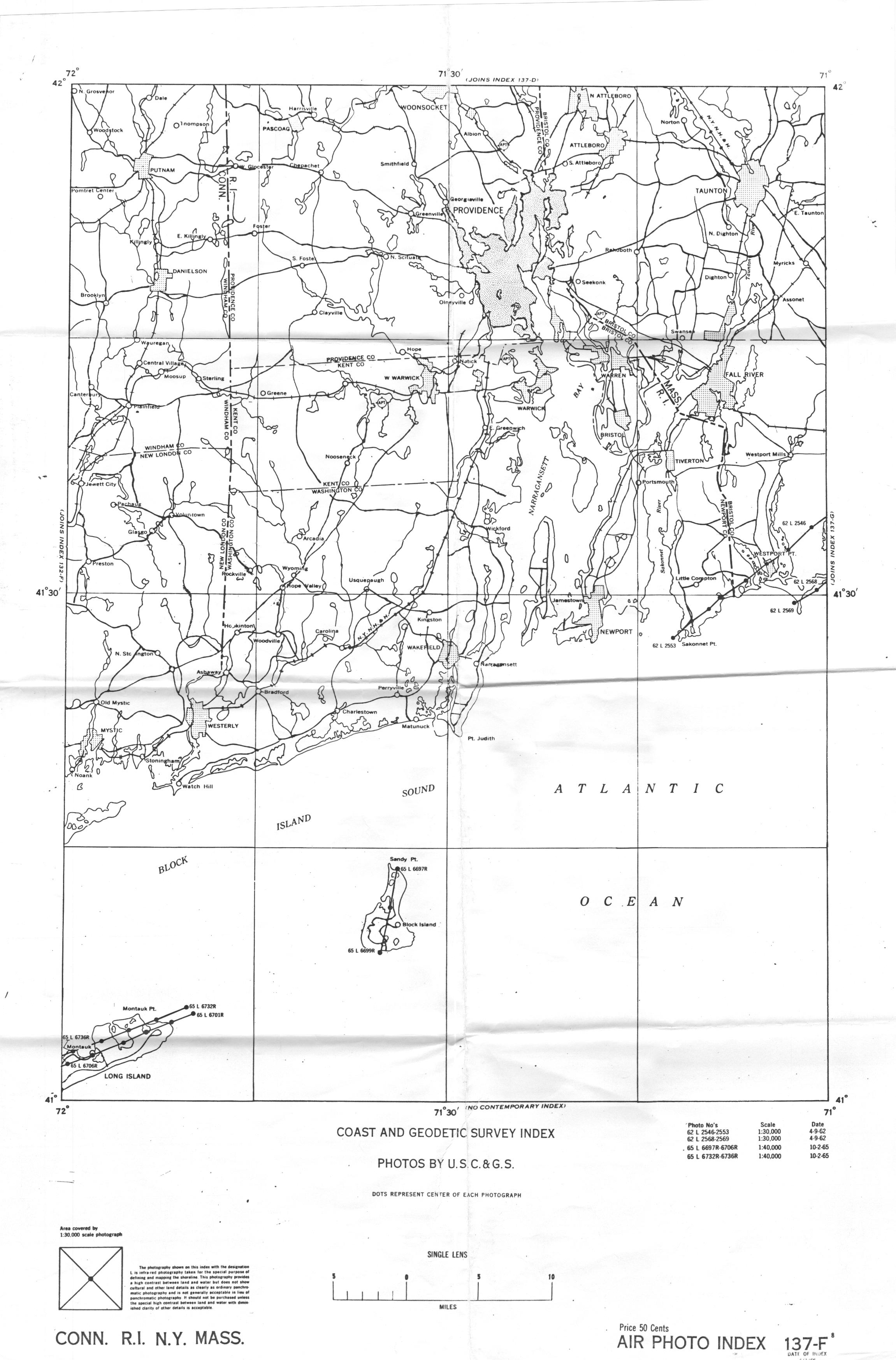
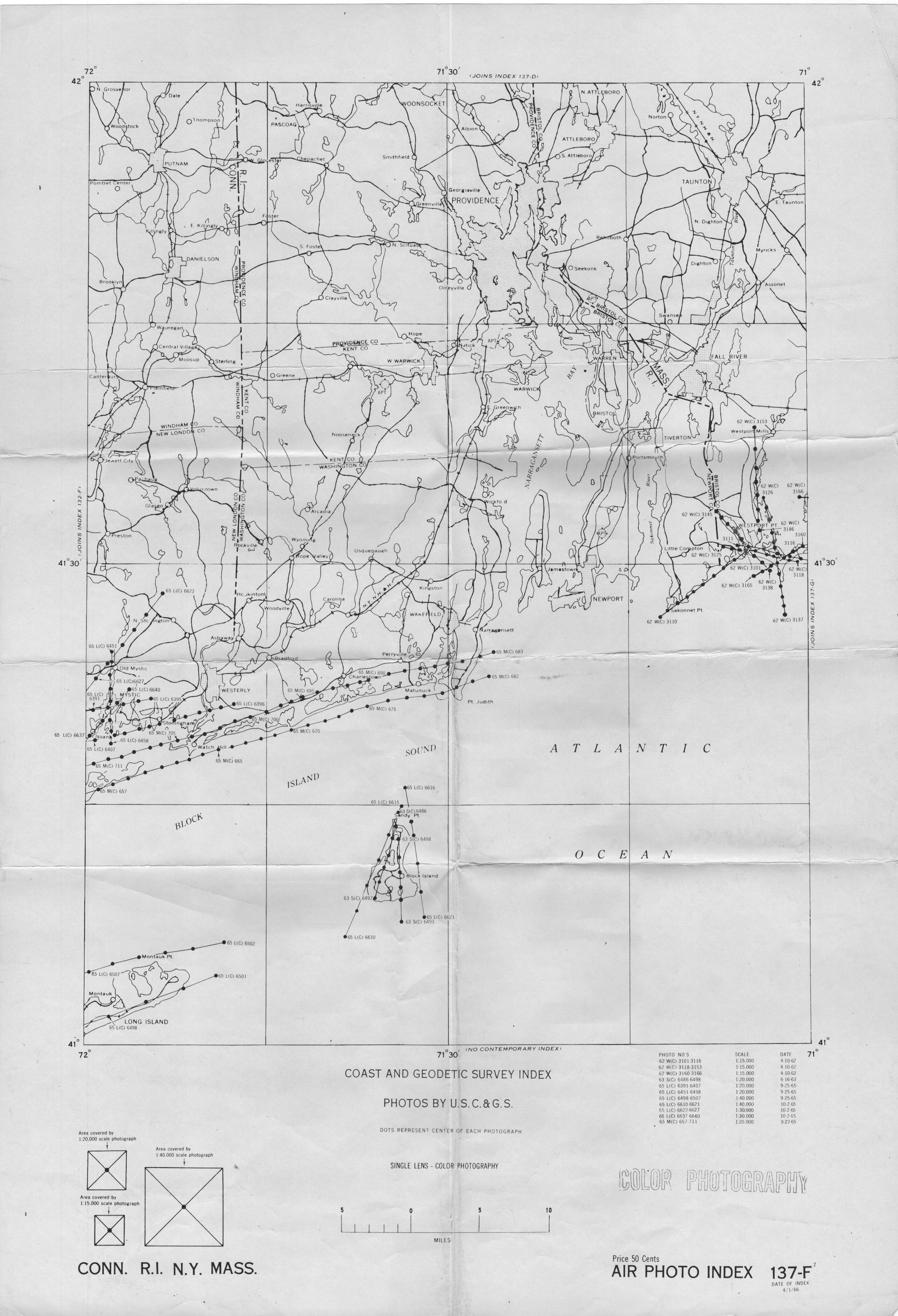
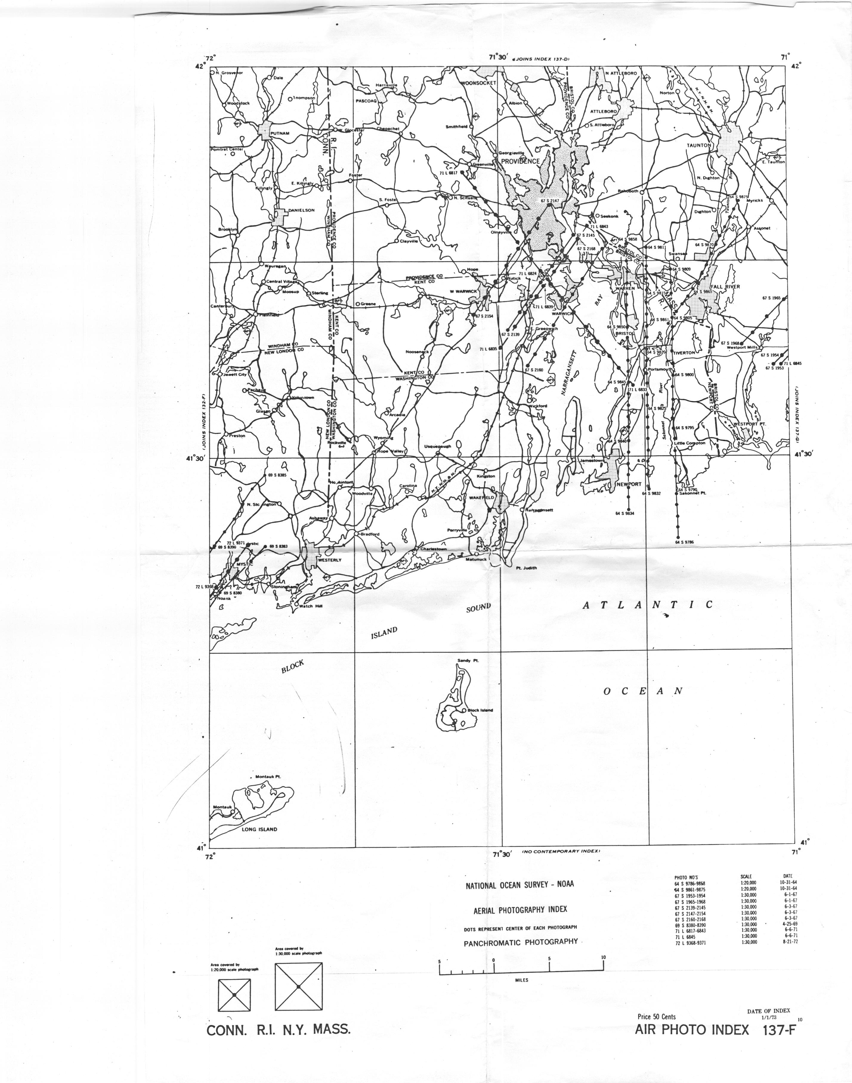
1) A NOS/CG&S “F” Index covers Rhode Island Sound through Westport, a “G” Index covers Buzzards Bay, Cape Cod and the Islands, and an F-G index covers both areas. Specific surveys may cross both F and G Indexes.
2) Non NOS/CG&S image scale may be estimated values, and not reported values
3) For each known date, in the comment field, add any high and low tides and heights between UTC 1400 and UTC 2000 as per this website: http://tbone.biol.sc.edu/tide/tideshow.cgi
document of interest: McConnell, et. al 1974, Remote sensing Barnstable County 1951-1971