Related pages: Interactive map of marsh monitoring sites | Migrating salt marshes | Tidal Elevations and Datums in Buzzards Bay | Tidal Datums and the HTL | Interactive Tidal Datum Viewer
Salt marshes in Buzzards Bay provide a vital role by providing habitat, regulating water quality, and stabilizing coastlines. In recent years, many coastal towns have experienced the degradation or loss of their salt marshes. In order to better understand and halt this trend, the Buzzards Bay National Estuary Program and the Buzzards Bay Coalition, in partnership with the Massachusetts Maritime Academy, are collaborating on a long-term study of salt marsh loss around Buzzards Bay.
Monitoring and tracking changes over many years within a dozen selected salt marshes will improve our understanding of the causes of marsh loss. In particular, we are focusing on how climate change, pollution, and changes in the abundance of certain crab species may be affecting our salt marshes. Using transects, which are defined paths our team will follow through the marsh on every visit, information will be collected on the height, abundance, and species of vegetation, as well what species of shellfish and crab live there. Elevations will also be taken as a means of monitoring how well area salt marshes are adapting to sea level rise. The monitoring program has been designed to minimize impacts and disturbance of the marsh study sites. The results of this work will help town officials and state and federal mangers develop possible mitigation strategies to protect and restore salt marshes.
Work being undertaken
Six activities are planned as part of this long-term salt marsh loss monitoring study:
1) We will install elevation survey benchmarks. The NEP is the lead on this task. These benchmarks will either be brass markers installed in boulders or in concrete bridge abutments or other structures, or they will be a stainless steel rod driven into the ground, surrounded by a concrete tube with a lid, flush to the ground;
2) Transect markers will be installed in the marsh. These consist of white PVC pipe or other markers. The markers will be reference points for transects to measure elevation and vegetation types within the marsh;
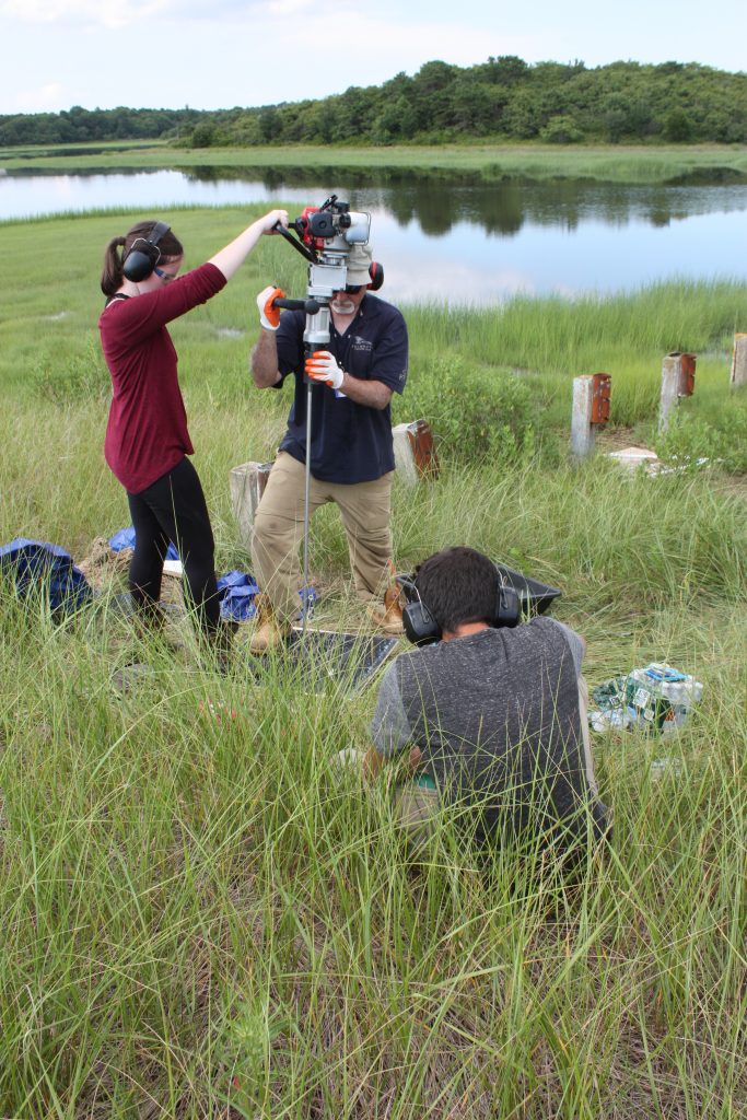
3) Along these marsh transects, we will monitor elevation, vegetation, and other features one or two times per year. The NEP with assistance from MMA students will undertake the elevation surveys. The Buzzards Bay Coalition will undertake the vegetation and fauna surveys. These annual surveys may continue for many years;
4) We will conduct a crab population survey periodically with traps to document the species of crabs common to each marsh and their abundance;
5) We will install sensors on a temporary staff in a tidal creek to document tidal elevation; and
6) Periodically, using volunteers, we will document the elevation of the High Tide Line during different tidal and weather conditions.
If you have questions or would like additional information about this study, please contact: Joe Costa at (508) 291-3625 x11 or email joe.costa@mass.gov. More information about the project can be found at this Buzzards Bay Coalition post.
Update:
On October 11, Restore America’s Estuaries and the U.S. Environmental Protection Agency (EPA) announced $1.2 million in funding to six local partnerships in Massachusetts through the Southeast New England Program (SNEP) Watershed Grants. Among the grants, the Buzzards Bay Coalition will receive $223,533 for a project to promote salt marsh resilience by supporting research to better understand causes and trends of marsh loss on Buzzards Bay and for pilot-scale restoration activities to preserve threatened marshes.
For more information, see the SNEP grant announcement.
See also this information page: Long-Term Buzzards Bay Salt Marsh Study – Buzzards Bay National Estuary Program