We at the Buzzards Bay National Estuary Program (NEP) have had a busy year. Perhaps most importantly, we were able to award $1.7 million in grants and subawards to Buzzards Bay municipalities and other partners. These funds were made available from the U.S. Environmental Protection Agency (EPA) through the Infrastructure Investment and Jobs Act and the Southeast New England Program. We also provided technical support in diverse areas ranging from stormwater discharge monitoring and mapping, GIS analysis and map production, salt marsh mapping, and watershed nitrogen loading analyses. We summarize our program’s 2023 highlights below.
Water Quality Grant Awards – In April, the Buzzards Bay NEP announced $808,500 in federally funded grant awards for projects that will improve water quality in the Buzzards Bay watershed by upgrading wastewater treatment plants and reducing stormwater runoff pollution with funding from EPA pursuant to the Infrastructure Investment and Jobs Act of 2021. The three grants are leveraging $484,000 in local cash and in-kind services. See the Press Release for details, along with this article on CapeCod.com: Bourne gets state money for Queen Sewell Pond cleaning. The following grants were awarded:
- Bourne – $183,500 to hire an engineering firm to design stormwater treatment options to address nutrient and bacteria loading to Queen Sewell Pond, which has caused beach closures due to harmful algal blooms and elevated bacteria levels.
- Dartmouth – $250,000 to make modifications to the town’s wastewater treatment facility to better meet permitted discharge limits for certain pollutants and significantly reduce nitrogen discharges to Buzzards Bay, potentially removing more than 100,000 pounds of nitrogen pollution each year.
- New Bedford – $375,000 to complete Phase II of the Buttonwood Park stormwater management project, which will address sediment erosion and pollutant discharges from the Buttonwood Senior Center property and nearby neighborhoods, including waste from a large Canada geese population.
Grant Awards for Water Quality and Habitat Improvement – In October, the Buzzards Bay NEP released $558,531 in federally funded grant awards for projects that will improve water quality and habitat in the Buzzards Bay watershed with funding from EPA pursuant to the Infrastructure Investment and Jobs Act of 2021. The grants also leverage $336,000 in local, state, and federal funds and in-kind services and help meet climate resilience and environmental equity goals of the Commonwealth. See the Press Release for more information. For press coverage, see: Studies on nitrogen reduction in sewage receive funding from Wareham Week; 4 Mass. towns get $550K to help protect Buzzards Bay Watershed from MassLive.com; and $558,531 granted for Buzzards Bay water quality and habitat projects: Fairhaven, New Bedford, Wareham, and Westport benefit from Hoodline. The following communities received funding:
- Fairhaven – $125,000 to improve water quality in Outer New Bedford-Fairhaven Harbor by reducing pollution from stormwater runoff. The grant will fund stormwater retrofits including green infrastructure designs to treat road runoff from Jerusalem Road and leverage other state funding. The runoff currently discharges to a shellfish growing area, causing the area to be closed periodically to shellfishing after rainfall.
- New Bedford – $93,531, in partnership with Groundwork Southcoast, to hire an engineering firm to conduct a feasibility study and develop design plans for creating salt marsh habitat in a manmade pond in Riverside Park. The pond is currently overgrown with invasive species and is often used as a dumping ground. The project will return the area to a natural state and create tidal exchange with the Acushnet River. Groundwork Southcoast and their Green Team, which employs area youth, will work with the city and residents to build environmental stewardship and help ensure that designs for the popular waterfront park meet community needs and environmental sustainability goals.
- Wareham – $275,000, in partnership with the Marine Biological Laboratory, to scale up prior pilot studies that showed nitrogen levels can be lowered and effluent quality significantly improved at the Wareham Water Pollution Facility by passing effluent through biofilters composed of wood chip media. The proposed Phase 2 field trials will explore how earlier pilot experiments can be scaled to 40-foot-long reactors and will calculate flow rates and infrastructure needed to handle daily flows. The municipal facility currently has stringent nitrogen limits imposed on its discharge, and the new bioreactor technology, which is more cost effective than other approaches, would help the town further reduce its nitrogen loading to coastal waters. If successful, the new technology will allow for the increased capacity of the wastewater facility and much needed expansion of sewering in the town.
- Wareham – $40,000, in partnership with the Buzzards Bay Coalition, to assess the feasibility of constructing a neighborhood-scale wastewater system, with the purpose of reducing nitrogen pollution from onsite septic systems near Little Harbor Beach on Great Neck. The study will identify potential nearby town-owned property outside the flood zone where the facility might be sited.
- Westport – $25,000 to hire a consultant to assist the town with monitoring and investigating municipal separate storm sewer system (MS4) discharges to comply with its federal stormwater permit. The proposed work will safeguard waterbodies and groundwater by assisting with control of polluted stormwater runoff, which is a major cause of water quality impairments in the town.
Report on Salt Marsh Health in Buzzards Bay – The Buzzards Bay Coalition, Buzzards Bay NEP, Woodwell Climate Research Center, and USGS have released Buzzards Bay Salt Marshes: Vulnerability and Adaptation Potential, a report on monitoring data on salt marsh loss from 12 sites in Buzzards Bay. Some sites measured up to 20 percent loss over the 18-year period, largely due to climate-driven sea level rise inundating low marsh elevations. See the Buzzards Bay Coalition Special Reports page for a link to the report.
Buzzards Bay Targeted Grants – With funding from the Southern New England Program’s (SNEP) Clean Water Act Section 320 funds and the Bipartisan Infrastructure Law funds, the Buzzards Bay NEP was able to provide this targeted grant support:
- Baywatchers Program – The NEP continued to support the Buzzards Bay Coalition’s Baywatchers water quality monitoring program with a $60,000 grant. For 31 years, Baywatchers has collected basic water quality, nutrient, and algal pigment information around Buzzards Bay during the summer and educated the public on local water quality. Since 1992, this effort has directly engaged more than 1,000 citizen scientists and has resulted in an impressive dataset of long-term trends for the ecological health of over 200 locations around the Bay.
- Nutrient Inputs to Buzzards Bay from Coastal Rivers – Discharges of nitrogen and phosphorus into coastal rivers are a major source of these nutrients in Buzzards Bay. Although the water quality in the estuarine embayments has been monitored for 31 years as part of the Buzzards Bay Coalition’s Baywatchers program, the nutrient input contributed by rivers remains poorly understood. Quantifying nutrient flows from rivers is important for validating watershed pollutant loading models and for understanding how residential and commercial development, land and agricultural management, and ecological restoration activities influence nutrient delivery to Buzzards Bay. Because climate change will bring increasingly variable precipitation to the Northeast, understanding river-borne sources of nutrients to Buzzards Bay will be critical to addressing nutrient loads to the Bay in the future. With a $45,948 award to the Woodwell Climate Research Center of Woods Hole this summer, this river monitoring effort, led by Woodwell scientist Chris Neil, will continue for a third year. This funding helped pay for continuous monitoring equipment and laboratory testing to measure nitrogen inputs to Buzzards Bay from coastal rivers.
- Buzzards Bay Long-Term Salt Marsh Study – Salt marshes in Buzzards Bay play a vital role by providing habitat, regulating water quality, and stabilizing coastlines. In recent years, many coastal communities have experienced degradation or loss of salt marshes. To better understand and halt this trend, the Buzzards Bay NEP continued for a fourth year to provide technical support to the Buzzards Bay Coalition and scientists at the Woodwell Climate Research Center to track salt marsh loss in Buzzards Bay principally caused by factors related to climate change. The NEP is interpreting historical aerial photographs and processing elevation data from Global Positioning System (GPS) and field surveys. In 2023, the UMass Dartmouth Civil and Environmental Engineering program, with students of Professor Dan MacDonald, continued their effort for a second year. A $53,308 award for this project enabled UMass Dartmouth to conduct field surveys using Unmanned Aircraft Systems. The imagery will be processed with photogrammetry software to generate highly detailed Digital Surface Models and georectified true color imagery. UMass Dartmouth will use existing National Geodetic Survey rod benchmarks installed by the Buzzards Bay NEP as elevation controls. The work will continue through 2024. For more information on the marsh studies, see this Buzzards Bay NEP web post.
- New Bedford Public Schools Sea Lab Summer Program – The Sea Lab Marine Science Education Center is a New Bedford Public Schools summer school program supported through tuition and the Local Education Agency. One of the fundamental elements of the Sea Lab program is its focus on providing educational equity for all public-school students. For a second year, the NEP supported the program with a $22,604 award for Sea Lab. The funding provides scholarships to up to 40 financially disadvantaged students in support of Environmental Justice goals and funds a field trip to Cuttyhunk Island in Buzzards Bay, a whale watch off Cape Cod, and various supplies and instructional aids for the program..
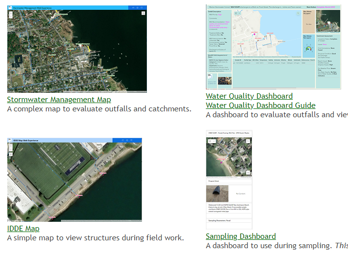
- Buzzards Bay Stormwater Collaborative – The Buzzards Bay Stormwater Collaborative is a partnership between the NEP, Massachusetts Maritime Academy (MMA), and eight Buzzards Bay watershed municipalities (Acushnet, Bourne, Dartmouth, Fairhaven, Marion, Mattapoisett, Wareham, and Westport). The focus of the collaborative is to monitor stormwater discharges and map stormwater networks (particularly those contributing to shellfish beds closures) and other municipal stormwater discharges covered under federal MS4 stormwater permits. In December, the NEP continued its support with a $127,042 award to MMA using EPA funds from the Bipartisan Infrastructure Law to support an MMA program manager and certain administrative costs of MMA co-op students in the program. The students are funded directly by the municipalities in the Collaborative. In 2023, local contributions totaled $79,500 cash, plus municipal in-kind services from staff working with students in the field collecting samples. The Buzzards Bay NEP continues to provide technical oversight, GIS management, data processing and analysis, and free laboratory testing services to municipalities in the Stormwater Collaborative. Training videos for the program can be found at the Buzzards Bay Stormwater Collaborative YouTube channel. For additional information, including an updated interactive map of stormwater infrastructure and discharge water quality data, see the Buzzards Bay Stormwater Collaborative page.
Technical Assistance – The Buzzards Bay NEP continued to assist municipalities and other partners with GIS analysis, proposal development, review of local projects, and training and support for municipal stormwater MS4 permit compliance. The NEP provided more than 650 map and GIS products to the Buzzards Bay Coalition, area land trusts, and municipalities in their efforts to protect important habitat and open space in Buzzards Bay. The Buzzards Bay NEP continues to work with the Buzzards Bay Coalition Science Advisory Committee and a team of scientists in Woods Hole to identify pressing issues related to climate change, nitrogen and toxic pollution, and loss of wetlands habitat and living resources in Buzzards Bay.
Southern New England Program Support – The Buzzards Bay NEP is an advising partner to EPA in implementing SNEP and is a supporting partner to several SNEP and MassDEP grant awards.
Watershed Assessment – The Buzzards Bay NEP is continuing its support of a five-year watershed protection effort on Apponagansett Bay by the Buzzards Bay Coalition funded under the SNEP Pilot Watershed Initiative. The SNEP funding has helped the Town of Dartmouth and City of New Bedford identify and prioritize sources of watershed impairments and develop solutions to address stream alteration and nutrient loading in an urbanized section of the Buttonwood Brook-Apponagansett Bay area of Massachusetts. The Buzzards Bay NEP is supporting the effort by providing land use analysis and GIS services during the five-year project to support total maximum daily load (TMDL) development. The program has paid dividends in generating three additional infrastructure grants totaling more than $1 million dollars from state and federal agencies.
TMDL Assessment – The NEP is continuing to work with the Town of Bourne and the Buzzards Bay Coalition on a MassDEP 604(b) grant to conduct a TMDL assessment for Red Brook Harbor Phinneys Harbor Complex in the Town of Bourne. The NEP tasks include conducting GIS analyses of watershed land use, including the number of onsite systems; determining occupancy rates for census data; and determining land use types, including estimates of impervious area, lawn area, extent of sewering, and assessment of pollutant loadings.
Runnel Study – The NEP is continuing to provide technical support to a Runnel Study that is a collaboration between Towson University, the Woodwell Climate Center, and the Buzzards Bay Coalition. Scientists are looking at how the use of runnels—constructed shallow drainage meanders—may promote revegetation in upper areas of salt marsh that are dying off from standing water. The results of this work will help town officials and state and federal mangers develop possible mitigation strategies to protect and restore salt marshes. The NEP is documenting changes in marsh boundaries and processing GPS and elevation data for the study. Assistant Professor Alice Besterman of Towson University is lead investigator.